| | | Editorial
Dear reader,
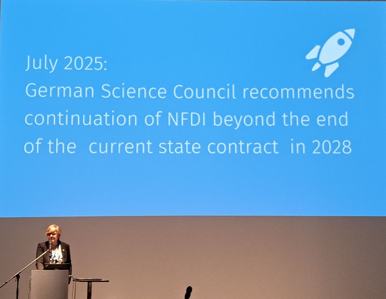
let’s start with the best news: as some of you may have followed, at its meeting on 10 July 2026, the Joint Science Conference (GWK) approved both a new Federal State Agreement (BLV) on the continued funding of the overall NFDI for 2028–2038 and the continuation of the NFDI second-round consortia including NFDI4Earth which is a huge success for us – once again, many thanks to everyone who contributed to this!
We are stepping up our outreach — so expect to see more of us at your own community and society meetings, too. If you would like us to join yours, please get in touch and of course, please fill in our actual survey on engaging academic societies in NFDI4Earth.
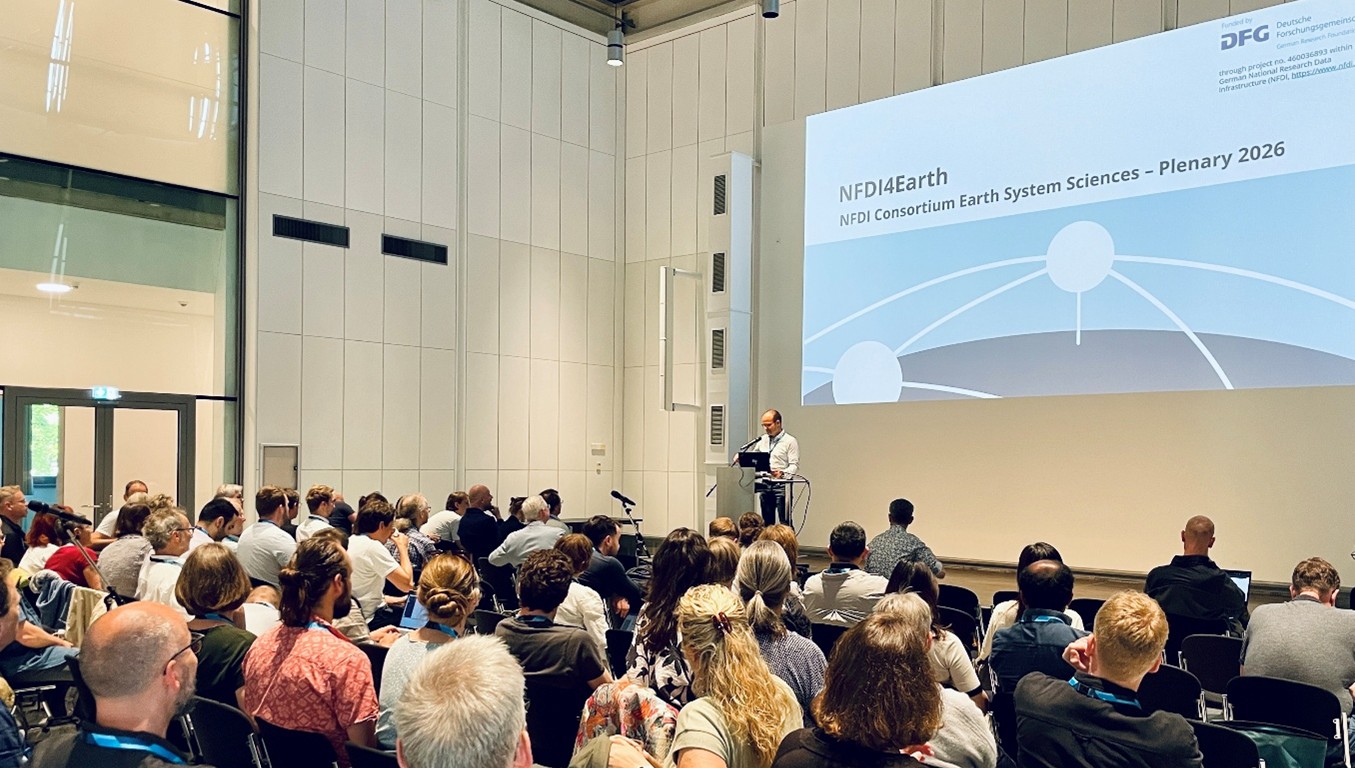
After a successful participation at the EGU General Assembly 2026 at the beginning of May, another important event took place just three weeks later: our annual Plenary was held, again at Deutsches Hygiene-Museum Dresden where we both looked back over the past five years of our first funding phase and showcased our results as well as we ventured a glimpse into the future of NFDI4Earth.
Remember that our newsletter functions as an information hub based on your contributions - so please contribute! The newsletter is published quarterly and the next deadline for submissions is 20 September. For any further details see the NFDI4Earth webpage.
And now: enjoy reading!
The NFDI4Earth Newsletter Team
| |
|
| | Meet us here 15 - 21 Aug 2026: IJCAI-ECAI 2026, Bremen, Germany 15 - 16 Sept 2026: Water Research Horizon Conference 2026, Berlin, Germany 20 - 24 Sept 2026: GeoMinBochum 2026, Bochum, Germany 28 Sept - 2 Oct 2026: 9th Japanese-German Meeting on Urban Climatology, Berlin, Germany 30 Sept - 2 Oct 2026: Geography Connect Convention 2026, Osnabrück, Germany 7 Oct: The future of interoperable Earth system data infrastructures, Brussles, Belgium Participate in NFDI4Earth Survey on Engaging Academic Societies in NFDI4Earth
Spot on... NFDI4Earth
NFDI4Earth Offers Guidance on Long-term Preservation of ESS Data What You Can Do to Help Integrate FAIR and Open Data Practices in Research Assessment Pilots and Incubators Showcases of Earth System Sciences
NFDI4Earth Outcomes NFDI4Earth Helpdesk: Question of the Quarter RecaRecap: School on Statistics and Time-Series Analysis and Academy Farewell of the 2nd cohort Working together for FAIR Research Data Management: NFDI4Earth @ EGU 2026 NFDI4Earth Plenary 2026 Recap VISQAM Incubator Project at GeoAI 2026 Conference NFDI4Earth at the final Geo-INQUIRE Annual Meeting 2026 NFDI4Earth at the EOSC-related Projects Annual Meeting
News from the RDM & Earth System Science Community Preserving Valuable Research Data: NFDI4Earth Supports Data Security in Earth System Sciences
International News Join Europe’s Earth Science Labs Community | |
| | NFDI4Earth Live at National and International Events
| NFDI4Earth supports the digital transformation of Earth System Sciences in Germany by advancing shared standards, best practices, and innovative solutions for research data management. Through its distributed infrastructure, the initiative provides FAIR and open access to Earth science data, tools, and data science methods.
To strengthen engagement with the research community across all Earth System Science disciplines, NFDI4Earth representatives took part in several events during the first half of 2026. Participants had the chance to learn more about NFDI4Earth, its services, products, and various opportunities for collaboration. This form of engagement will be continued into the second half of the year, when you’ll be able to meet us at the following events, among others.
| | 15 - 21 August 2026: IJCAI-ECAI 2026, Bremen, Germany
|
|
The 35th International Joint Conference on Artificial Intelligence is fostering the exchange of groundbreaking advancements and achievements in AI research.
The conference is organised in several special tracks: Human-centered AI, AI for Social Good, AI4Tech: AI Enabling Critical Technologies, AI and Health, AI and Robotics and Survey Track. |
| | Picture credit: IJCAI-ECAI Bremen 2026 |
|
|---|
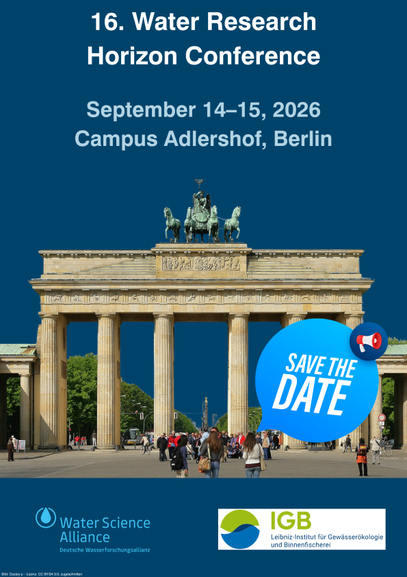
| 14 - 15 September 2026: WRHC 2026, Berlin, Germany
| | Picture credits: WRHC 2026 |
| |
|---|
| 20 - 24 September 2026: GeoMinBochum, Bochum, Germany | | Picture credits: German Geological Society (DGGV) and the German Mineralogical Society (DMG)
| GeoMinBochum 2026 is hosted by the German Geological Society (DGGV) and the German Mineralogical Society (DMG). Under the theme "Small, Fragile, Blue Planet – Our Shared Home – Located 25,000 Light-Years from the Centre of Our Galaxy", the conference brings together geoscientists from a wide range of disciplines, encompassing field, analytical, and experimental work, as well as numerical modelling of fundamental and applied research through geological time, to address the most pressing scientific questions about our changing planet.
|
|
|
|---|
28 September - 2 October '26: 9th Japanese-German Meeting on Urban Climatology, Berlin, Germany |
|
|---|
| The 9th Japanese-German Meeting on Urban Climatology will take place in Berlin from 28 September to 2 October 2026. This event continues a long-standing scientific collaboration between German and Japanese researchers that began in 1994, focusing on the incorporation of climatological insights into urban planning, surface energy and water balance, human biometeorology and public health, urban greenhouse gas monitoring, and air quality and related topics. |
| | Picture credits: Japanese-German Meeting |
|
|---|
| 30 September - 2 October 2026: Geography Connect Convention, Osnabrück, Germany
| | Picture credits: Geography Connect Convention
| The Geography Connect Convention (GCC) is a new forum for geographers from both academia and practice. It thrives on enthusiasm for a discipline that builds bridges between humans and the environment, theory and practice, and the local and the global. At its core is the idea of transdisciplinary connection: between people, topics, perspectives, and pathways into and through geography. The GCC provides a framework for open exchange, diverse perspectives, and engaged discussions and is aimed at anyone who wants to help shape geography. | |
| | 7 October 2026: The future of interoperable Earth system data infrastructures, Brussels, Belgium
|
|
|---|
| While Europe has invested substantially in building powerful research infrastructures and the European Open Science Cloud (EOSC), the next challenge is to connect these complementary ecosystems into a coherent, sustainable and AI-ready European data ecosystem for Earth and environmental sciences.
On 7 October 2026 a joint Memorandum of Understanding between Data Terra and NFDI4Earth, the French and German national initiatives for research data management in Earth system sciences, will be signed in Brussels, representing an important step towards leveraging this work onto the European scale.
By combining complementary expertise, services and communities, both initiatives aim to demonstrate how national infrastructures can work together to naturally embed national activities into EOSC and thereby strengthen the EOSC Federation by providing researchers with integrated services for multidisciplinary science. The MoU will act as a concrete demonstration of this shared vision, establishing a framework for long-term cooperation and for the joint development of interoperable services.
More information about the event will be available soon on Data Terra and NFDI4Earth web pages as well as through Data Terra and NFDI4Earth LinkedIn profiles. | |
| Participate in NFDI4Earth | Survey on Engaging Academic Societies in NFDI4Earth | |
Academic societies play a key role in science: they connect researchers, foster scientific exchange and shape debates within our communities. To strengthen the dialogue on FAIR and open research data, NFDI4Earth aims to work more closely with societies in the field of Earth System Sciences in the future. With a short survey, we would like to identify those within the NFDI4Earth community who are already members of an ESS-related society in Germany or is actively involved with one; your experience and contacts will help us build effective communication and develop targeted outreach activities.
If you are a member of or actively involved in such a society, we invite you to complete the short survey at: Engaging Academic Societies in NFDI4Earth
Thank you for supporting the NFDI4Earth community!
The NFDI4Earth Coordination Office (TU Dresden) | |
| | NFDI4Earth Offers Guidance on Long-term Preservation of ESS Data | Securing the long-term preservation of relevant data is a key component for a sustainable data culture and responsible research data management in Earth System Sciences (ESS) and science in general. Long-term preservation requires the participation and involvement of various stakeholders throughout the data life cycle. NFDI4Earth is offering support to the community on this topic with a set of comprehensive guidelines, addressing different stakeholders and their role within the preservation process.
For data producers the Guidelines for the Preparation of Data for Archiving offer support on what needs to be considered during data preparation and processing in order for the data to be preserved in the long term. The Guidelines for Repository Providers provide support for the implementation and improvement of preservation policies and workflows within repositories as the custodian of research data in the long term. The Guidelines for the Appraisal of ESS Data for long-term Preservation and Archiving offer recommendation on how to approach the process of appraising and selecting ESS data of lasting value for long-term preservation, relevant for the community as a whole.
Peter Valena (Bavarian State Archives, Munich)
| | What You Can Do to Help Integrate FAIR and Open Data Practices in Research Assessment! | | A new NFDI4Earth short paper examines how the FAIR Guiding Principles and open science practices for research data can be more effectively integrated into the systems that recognise and reward academic work. It outlines the current academic reward system, recent proposals for responsible research assessment such as DORA, the Leiden Manifesto, and CoARA, and the specific challenges around recognising research data quality and research data metrics.
The paper highlights how NFDI4Earth members – as researchers, members of academic societies, journal editors, and grant reviewers – can support the cultural shift required to reward FAIR and open research data practices alongside traditional publication metrics.
Andreas Hübner (Freie Universität Berlin) & Daniel Nüst (TU Dresden)
| | Pilots and Incubators Showcases of Earth System Sciences
| The event series “Pilots and Incubators: Showcases of Earth System Sciences" took place on February 19 and 26. A total of 11 NFDI4Earth pilots and incubators presented their work and shared insights into their ongoing developments.
In next five short articles, we highlight the last three of these pilots, coordinated by University Leipzig, and two incubators, coordinated by University Hannover. The first part of the projects were published in the last NFDI4Earth newsletter.
Kolja Nenoff (Leipzig University) & Udo Feuerhake (Leibniz University Hannover)
| | 3Dtrees.earth: A Global Platform for AI-ready Forest LiDAR Data
| Forests are three-dimensional ecosystems. Tree height, crown architecture, biomass, habitat structure, and structural diversity cannot be fully captured from two-dimensional observations alone. To document and analyse these structures, forest science increasingly relies on LiDAR point clouds, which provide detailed 3D information on individual trees, forest stands, and entire landscapes.
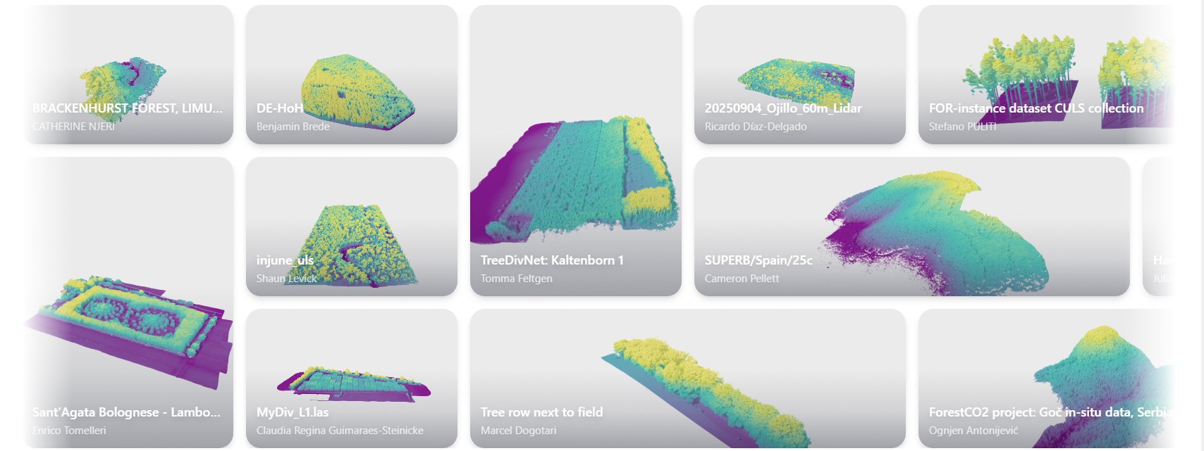
| | Screenshot of 3Dtrees.earth
| 3Dtrees.earth, launched in January 2026, is a global, community-driven platform for sharing, curating, and analysing 3D forest data. The initiative is headed by the Chair of Sensor-based Geoinformatics at the University of Freiburg together with several national and international partners. Within its first months, the platform has already crowdsourced more than 1,200 datasets from around the world, demonstrating the strong need for a shared infrastructure for forest LiDAR data.
Building on the experience of the NFDI4Earth-supported platform deadtrees.earth and the infrastructure concept of Galaxy Europe, 3Dtrees.earth combines high-quality research data management with computational resources. This allows computationally intensive AI analytics to be made available for every submission, without requiring users to run complex workflows locally or maintain specialised computing infrastructure.
By integrating FAIR data principles, scalable processing, and community contributions, 3Dtrees.earth aims to provide reference data layers for Earth observation applications, including the validation and calibration of satellite- and drone-based products. At the same time, it supports users in monitoring individual sites by providing information on tree dimensions, biomass, and structural diversity. In this way, the platform connects global forest monitoring with practical, local applications.
Teja Kattenborn, Julian Frey, Daniel Lusk, Janusch Vajna-Jehle, Kilian Gerberding & Benjamin Brede (University of Freiburg)
|
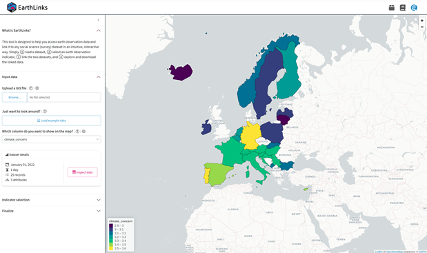
| EarthLinks – Easy Access to Earth Observation Data for Social Scientists | | Snapshot of the open-source R Shiny App published and hosted online for immediate use
| For many researchers in the social sciences, Earth observation (EO) data remains largely inaccessible. The domain requires specialist skills in data formats, APIs, and programming. EarthLinks was developed to close this gap by creating a user-friendly, open-source bridge between EO data sources and the everyday tools of social scientists.
The pilot delivers a comprehensive R Shiny App that allows social scientists to query, retrieve, and link Earth observation data, such as temperature and precipitation directly to their existing survey or behavioral datasets. Crucially, no programming experience is required. The tool handles spatially and temporally precise queries against Copernicus data services efficiently, even on standard workstations.
Dennis Abel, Stefan Jünger, Jonas Lieth, Amelie Veit (GESIS – Leibniz Institute for the Social Sciences)
|
| CAMELS-PLUS – Containerised, Reproducible Workflows for Hydrological Data
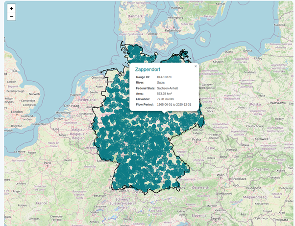
| | Snapshot of the current camels-de.org. All tools & datasets openly available and are constantly updated.
| Large-sample hydrological datasets like CAMELS-DE are invaluable for understanding catchment behavior and building data-driven models. Yet the workflows that produce them have long been fragmented and manual relying on custom scripts, undocumented parameters, and heterogeneous data sources that make reproduction and collaboration difficult. CAMELS-PLUS was designed to change this.
The pilot introduces a standardised, container-based framework for scientific data preprocessing and workflow management, built on a lightweight YAML/JSON/CFF specification the Computational Geoscientific Container standard. Each container follows a uniform directory structure and carries machine-readable metadata describing its inputs, parameters, and outputs.
The framework was validated through the complete CAMELS-DE processing chain, covering data acquisition, catchment delineation, meteorological forcing generation, and model preparation. Containers are language-agnostic, with reference templates in Python, R, Octave, and Node.js, and are published automatically to GitHub Container Registry for persistent, versioned access.
Users can reproduce any workflow step with a single Docker command on a laptop or an HPC cluster without dependency conflicts.
Carlos Zuleta Salmon & Mirko Mälicke (Karlsruhe Institute of Technology / KIT)
|
| LLM-enabled I-ADOPT Variable Extraction Using Semantics
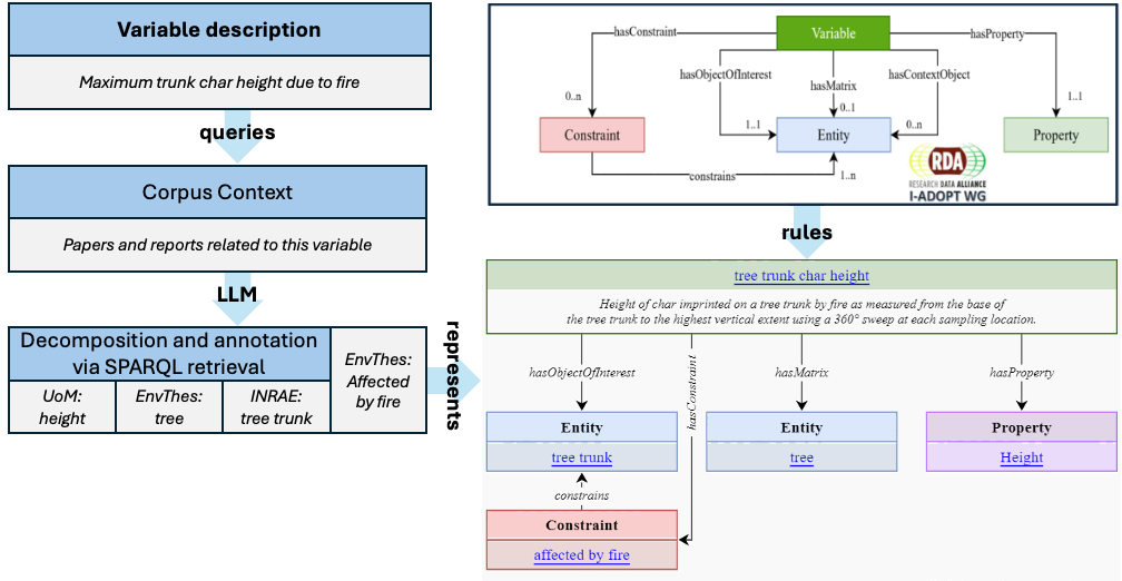
| | Schematic overview of the LLM-adaptation and the transformation of keywords and variable descriptions into atomic I-ADOPT-components
| The I-ADOPT LLM Service develops a workflow for transforming natural-language descriptions of observed variables into structured, machine-interpretable I-ADOPT components. This addresses a key challenge in research data management: variable descriptions are often inconsistent, domain-specific, and difficult to link across datasets, limiting findability, interoperability, and reuse.
The service uses large language models to decompose variable definitions into I-ADOPT elements such as property, object of interest, matrix, constraint, and context. These components can then be semantically linked to controlled vocabularies and knowledge bases, such as Wikidata. A demonstrator is provided through Jupyter notebooks, showing an end-to-end workflow from natural-language input to structured JSON output and linked semantic concepts.
The project supports FAIR data principles by reducing the manual effort required to create standardised variable descriptions. It also provides a foundation for future extensions, including pattern-guided decomposition, retrieval-augmented generation, and linking to multiple domain vocabularies such as ENVO, CHEBI, SWEET, and AGROVOC.
Overall, the I-ADOPT LLM Service contributes an important building block for interoperable metadata infrastructures within NFDI4Earth. It helps data providers, curators, and infrastructure developers create consistent, reusable, and machine-readable variable descriptions across Earth System Science domains.
Christof Lorenz & Arvin Rastegar (Karlsruhe Institute of Technology / KIT)
|
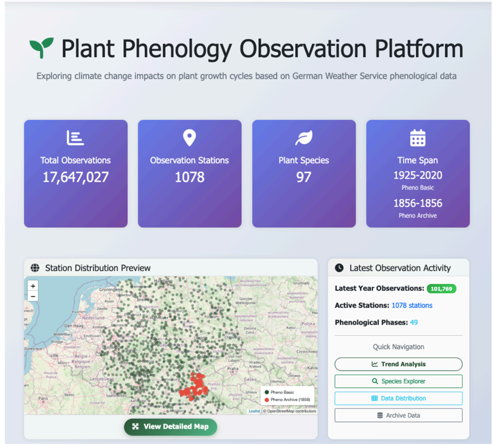
| PhenoMapping: A participatory Visual Tool for Curation & Verification of Historical Phenological Data | | The PhenoMapping platform supports map-based visualisation, temporal analysis, transcription, and verification of archive scans, and spatial-temporal data-gap exploration
| The PhenoMapping project developed a web-based platform for the curation, verification, and exploration of historical phenological data. Phenological observations, such as flowering, leaf unfolding, fruit ripening, and leaf fall, are important indicators for climate change research and Earth System Science (ESS). However, systematic German phenological records before the late nineteenth century remain rare, as many earlier observations are still hidden in analogue archival sources.
The project used a historical archive collection from the Amberg State Archive as a pilot case. The original proposal estimated approximately 7,000 observations from the 1855/56 archive material. During the project, the archive structure was further clarified and the dataset was compiled into 7,823 single observations from 68 questionnaires. The project delivered a functional web platform with modules for map-based visualization, temporal analysis, species-based exploration, transcription and verification, and spatial-temporal data-gap analysis. The software was published on GitHub, and a live prototype was deployed on AWS.
The project demonstrates how historical “dark data” from archives can be digitised, structured, and published for reuse in ESS. It also shows that human verification remains essential for historical phenological records, especially when handwritten notes, historical place names, and species names need to be interpreted.
Yu Feng and Puzhen Zhang (Technical University of Munich), Lina Hörl & Alois Wieshuber (Head Office of the Bavarian State Archives, Munich) | |
| | NFDI4Earth Helpdesk: Question of the Quarter
|
|
|---|
| The User Support Network Helpdesk answers the questions we receive in the internal ticket system. To give you an impression of our work, we will regularly present some of our tasks here. |
|
|---|
Question: What should researchers consider regarding research data management when developing climate models for the ancient past? Are there established data and metadata standards, suitable repositories, and recommendations for publishing these data according to the FAIR principles?
Answer: To answer this question, we consulted an expert from the German Climate Computing Centre (DKRZ), where climate model data are managed and archived.
Climate models for the ancient past generally fall into the field of paleoclimate simulations. These simulations use established climate or Earth system models together with historical boundary conditions such as greenhouse gas concentrations, land-use information, orbital parameters, or proxy-based reconstructions.
Several well-established standards support the management and exchange of climate model data. Commonly used formats include NetCDF (and increasingly Zarr for cloud-based environments), while metadata are typically described using the CF Conventions and the naming and metadata schemes developed within CMIP and PMIP. In particular, the Paleoclimate Modelling Intercomparison Project (PMIP) provides widely adopted conventions for paleoclimate simulations.
For publishing and preserving simulation results, researchers can use repositories such as the Earth System Grid Federation (ESGF) or the World Data Center for Climate (WDCC) at DKRZ, which offer long-term archiving and DOI assignment. Model code is usually version-controlled separately, for example through GitHub or GitLab.
To ensure that climate model data are FAIR, researchers should pay particular attention to documenting model versions, parameter settings, and boundary conditions, providing transparent temporal references, describing uncertainties and limitations, and including clear licensing and citation information.
A key recommendation is to involve the intended computing centre or repository early in the project to ensure that data and metadata requirements can be addressed from the beginning.
Ivonne Anders (German Climate Computing Centre / DKRZ, Hamburg)
| |
|
|---|
RecaRecap: School on Statistics and Time-Series Analysis and Academy Farewell of the 2nd cohort
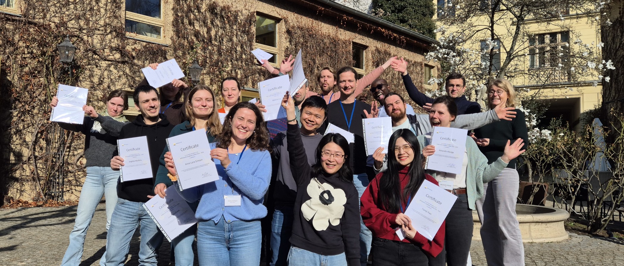
| | NFDI4Earth Academy Participants. Photo credits: Jonas Kuppler (GFZ, Potsdam & Geo.X)
| As the second Academy cohort came to an end, fellows, speakers, and the coordination team gathered one last time in Berlin from 16-18 March 2026. Hosted at Heckmann-Höfe, the final School and Farewell combined scientific training, reflection on the Academy journey, and discussions about the future of NFDI4Earth.
The two-day School on Statistics and Time-Series Analysis introduced key methods for analysing (geo)scientific data. Through lectures, hands-on exercises, and group work, participants explored exploratory statistics and regression techniques, data preprocessing and feature scaling, time-series analysis, and introductory machine learning approaches. The workshop was led by Annette Rudolph, TU Berlin and Kai Hartmann, FU Berlin.
The final day marked the farewell of the second cohort, including the certificate handover and a shared reflection on the Academy experience. Together with Dominik Hezel, participants discussed the next phase of NFDI4Earth and opportunities for Academy alumni to remain actively involved.
Looking back, fellows highlighted four aspects that shaped their experience: a strong sense of community and networking, the value of interdisciplinary exchange, new creative impulses for research, and continuous learning through knowledge sharing. Looking ahead, discussions focused on strengthening alumni engagement through structured communication, peer support, and the potential establishment of an NFDI4Earth Early Career Research Interest Group.
A big thank you to everyone who made this Academy what it was through your ideas, openness, and engagement.
Jonas Kuppler (GFZ German Research Centre for Geosciences, Potsdam & Geo.X) | | Working together for FAIR Research Data Management: NFDI4Earth @ EGU 2026
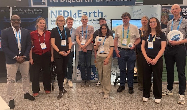
| | NFDI4Earth team at EGU 2026. Photo credits: NFDI4Earth Coordination Office
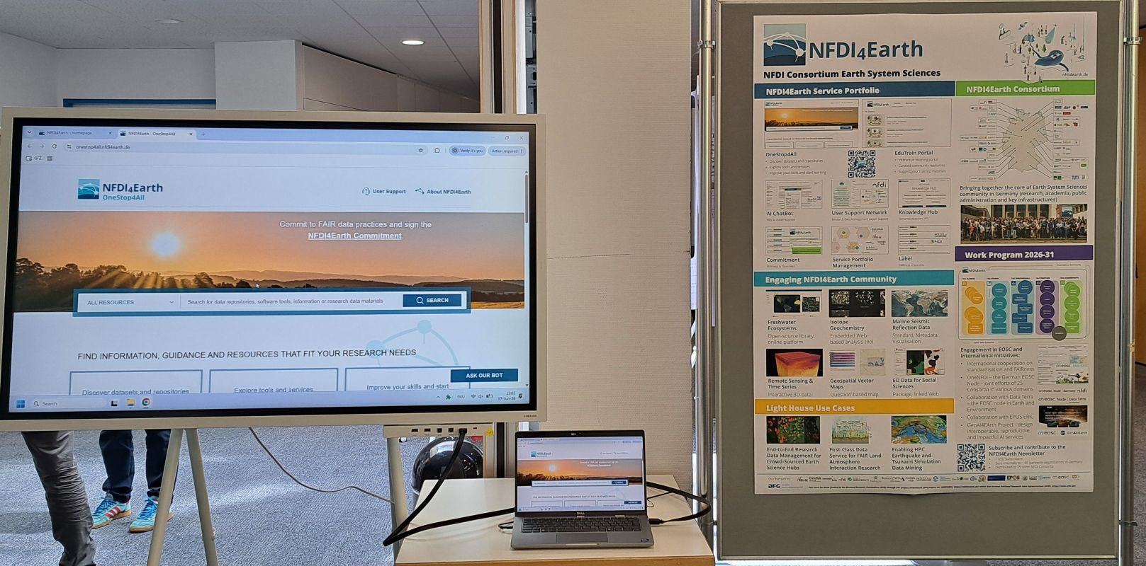
| From 3-8 May 2026, the NFDI4Earth team participated in the European Geosciences Union (EGU) General Assembly in Vienna. At the NFDI4Earth booth, researchers, students, and project partners learnt about current developments in Earth system science research data management and engaged directly with the consortium.
The team showcased key NFDI4Earth services, including the OneStop4All Portal, the Knowledge Hub, and the FAIRness and Openness Commitment. Additional booth pitches highlighted pilot projects and partner initiatives.
NFDI4Earth members also presented posters on FAIR research data management, user-centred services, spatio-temporal metadata for scientific literature search and many more. In the short course Discover Data, Repositories and Learning Materials – Advance your Research by Using Open ESS Services, participants explored practical approaches to finding datasets, selecting repositories, and using open learning resources.
A particular highlight was the town hall Joining Forces in Shaping the European Open Science Cloud, jointly organised with Data Terra. The session brought together perspectives from research, infrastructures, and science policy to discuss sustainable data spaces for Earth and environmental sciences.
EGU 2026 provided an important opportunity to strengthen community exchange and gain new insights for the further development of NFDI4Earth.
The NFDI4Earth Coordination Office (TU Dresden)
| | NFDI4Earth Plenary 2026 Recap
| From 27 to 29 May 2026, the annual NFDI4Earth Plenary took place again at Deutsches Hygiene-Museum in Dresden.
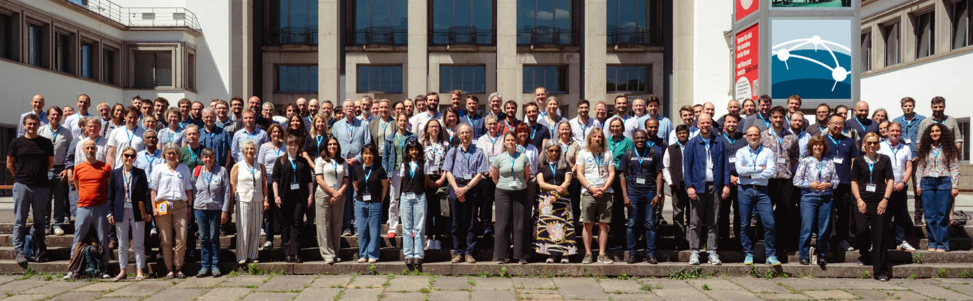
Around 130 participants from 67 partner institutions came together to strengthen the exchange within the community, continue joint developments, and discuss next steps for the second funding phase of the consortium. The plenary featured a diverse programme with emphasis on interactive formats and collaborative work. It opened on Wednesday with a set of community driven workshops, covering topics such as: - BITS - Semantic Tools in Earth System Science (A. Ganske, A. Lammert, A. Wolodkin)
- RDMO Earth-Sensor (C. Rebmann, B. Biskamp)
- TIB Knowledge Loom (M. Stocker)
- Geospatial Foundation Models (F. Gans, M. Pohl)
- Educational Concepts for NFDI4Earth (D. Hezel)
- Water Science & Hydro Use Cases (S. Domisch, J. Seegert)
| | Group photo of NFDI4Earth at Plenary 2026. Photo credits: D. Henzen (TU Dresden)
| On Thursday, a central part of the schedule was dedicated to presentations of Pilots and Use Cases from the first funding phase - especially: - German Marine Seismic Data Access (J. Berndt)
- GeoFresh (Sami Domisch)
- CAMELS-DE: Hydrological Datasets from and for the Community (A. Dolich)
- Deadtrees.earth: A Community Driven Infrastructure for Tree Mortality Monitoring from Local to Global (K. Gerberding)
- World Settlement Portal and EOC Data Portal (J.-K. Haug)
- PhenoMapping - A Participatory Visual Tool for Curation and Verification of Historical Phenological Data (Y. Feng)
- LLM-enabled I-ADOPT Variable Extraction using Semantics (A. Rastegar)
- Unlocking Multifunctional Insights with Near Surface Geophysical Data Harmonization (U. Werban)
|
|
|---|
| Lars Bernard (TU Dresden), NFDI4Earth. Spokeperson at Plenary 2026
|
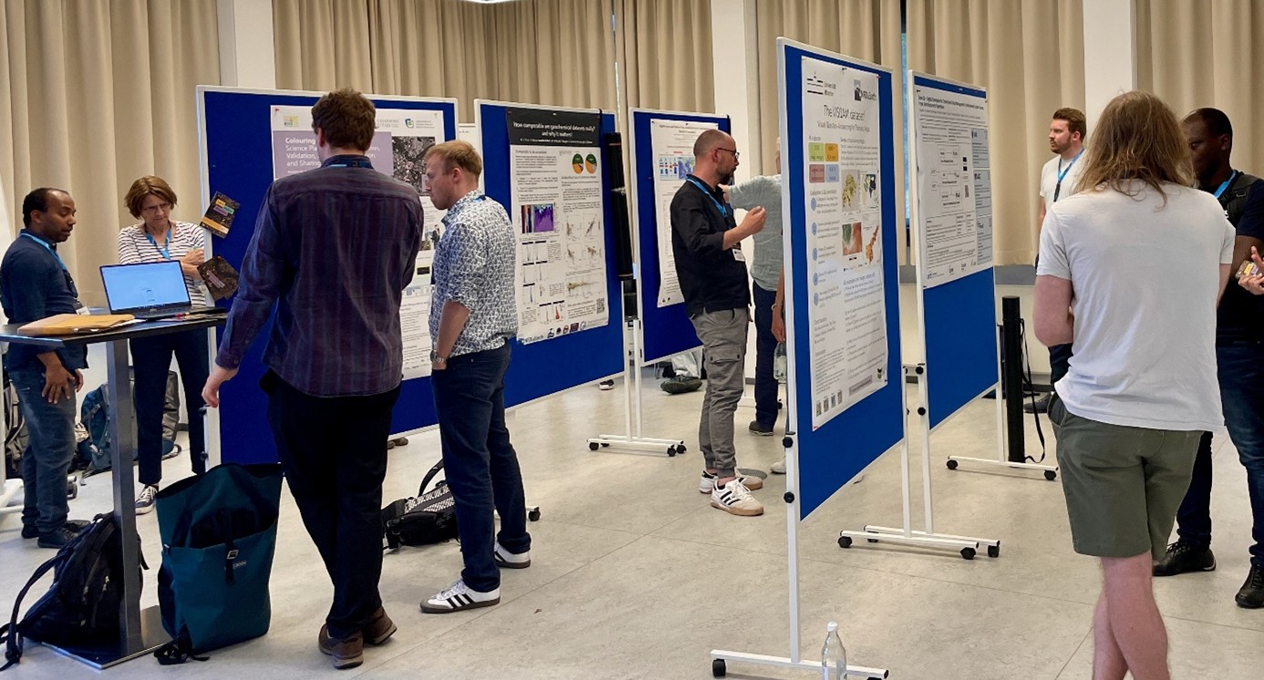
| | Poster session at NFDI4Earth at Plenary 2026. Photos credits: Dewi Josephine Obert (TU Dresden) |
|
|---|
Furthermore, hands-on workshops provided space for in-depth exchange on topics such as the NFDI4Earth Label, the Living Handbook, future Lighthouse Use Cases, AI applications in the Earth system sciences, and service information management. The programme was complemented by a software marketplace and a poster session. A selection of the presented posters is already uploaded in our NFDI4Earth Zenodo community. |
|
|---|
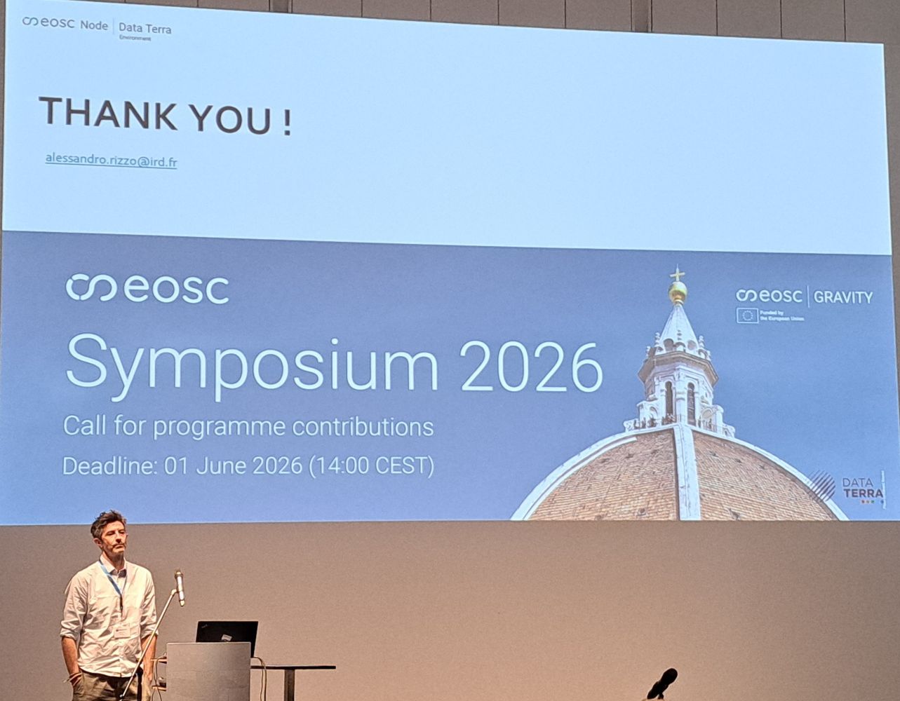
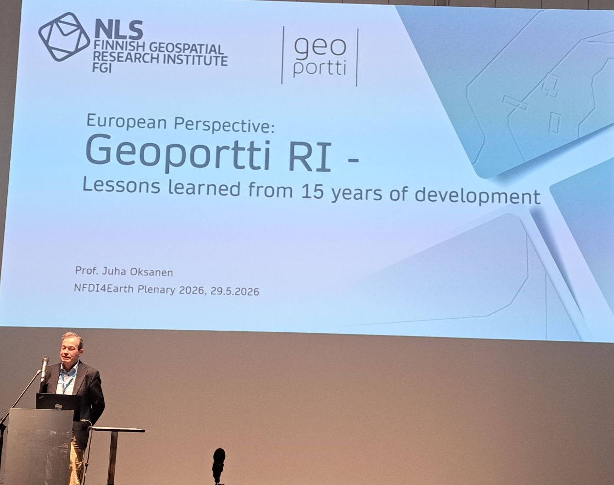
A. Rizzo (Data Terra, France), J. Oksanen (Geoportti, Finland) and B. Ebert (NFDI4Biodiversity) at NFDI4Earth Plenary 2026. Photos credits: V. Protopopova-Kakar (GFZ, Potsdam)
| International keynotes by Juha Oksanen (Geoportti, Finland), Alessandro Rizzo (Data Terra, France), and Barbara Ebert (NFDI4Biodiversity) added valuable external perspectives and highlighted broader European developments and opportunities for collaboration towards #OneNFDI, picking up on themes already discussed throughout the plenary in contributions from Base4NFDI, FAIRagro, NFDI4Objects, and NFDI4Biodiversity.
Thanks to all participants, contributors, and speakers for a successful NFDI4Earth Plenary 2026 and see you again next year!
The NFDI4Earth Coordination Office (TU Dresden)
| | VISQAM Incubator Project at GeoAI 2026 Conference
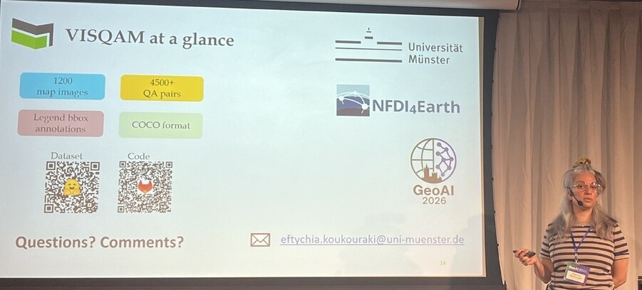
| | E. Koukouraki (University of Münster) at GeoAI conference. Photo credits: VISQAM Incubator Project
| NFDI4Earth goes to the first GeoAI conference! On 6 June, the last day of the conference, Eftychia Koukouraki from the Institute for Geoinformatics at the University of Münster presented the work on VISQAM, an Incubator Lab project, in Ghent, Belgium.
The project develops an open dataset designed to advance visual question-answering (VQA) for thematic geographic maps. The presentation sparked useful questions during the session (visualisation vs data-driven question answering) and interesting discussions afterwards. There was particular endorsement of the fact that all the materials, including the dataset, trained models and related code, are openly available and thus usable by the community.
The conference proceedings paper was co-authored by Ajay Ajay, Ahmad Abubakar, and Yomna Eid, all of whom are affiliated with the Institute for Geoinformatics.
Eftychia Koukouraki, Ajay Ajay, Ahmad Abubakar & Yomna Eid (University of Münster)
| | NFDI4Earth at the final Geo-INQUIRE Annual Meeting 2026
| | Photo credits: Valentina Protopopova-Kakar (GFZ, Potsdam)
| After four years of collaborative work, representatives from 51 partner organisations - national research institutes, universities, national geological surveys, and European consortia - gathered in Potsdam, Germany, from 16-18 June 2026 for the final Geo-INQUIRE Annual Meeting.
Over the course of the project, the Geo-INQUIRE consortium successfully organised more than 50 events, training opportunities, and courses covering seismology, volcanology, geology, geodesy, FAIR data, and related disciplines. The project also delivered numerous datasets and services for the solid Earth sciences while providing transnational access to partner laboratories, test sites, data services, and modelling tools.
During the Annual Meeting's Marketplace, NFDI4Earth had the opportunity to showcase its data services as well as its education and training materials. The event provided an excellent platform for fruitful discussions and networking among project partners, invited guests, and participants of the traditional GFZ International Training Course on Seismology, Seismic Data Analysis, Hazard Assessment and Risk Mitigation, which was held in parallel with the Annual Meeting.
Valentina Protopopova-Kakar (GFZ, Potsdam)
| | NFDI4Earth at the EOSC-related Projects Annual Meeting
|
|
|---|
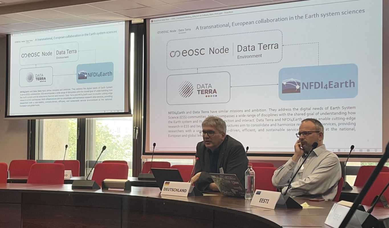
From left to right: Wolfgang zu Castell (GFZ, Potsdam), delegate from Estonia. Photos credits: Jean-Philippe Malet (Unistra, France & Data Terra)
| NFDI4Earth took part in the fifth annual coordination meeting of EOSC-related projects and the EOSC Federation build-up group, held in Brussels from 7–9 July 2026. Bringing together representatives from 34 Horizon Europe projects and 28 EOSC Nodes, the meeting focused on advancing the operational integration of the EOSC Federation and strengthening collaboration across the European Open Science ecosystem.
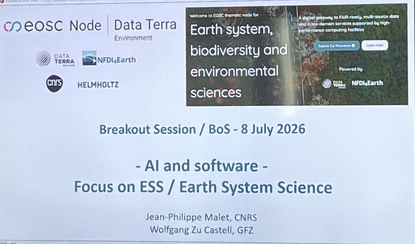
During the AI & Software breakout session, Wolfgang zu Castell (NFDI4Earth), together with Jean-Philippe Malet and Caroline Blanke (Data Terra), presented a shared vision for trustworthy AI in Earth System Science, highlighting that safe AI depends on trusted scientific infrastructures. They emphasized the importance of EOSC as a federated environment where FAIR data, software, AI models, and scientific workflows can be managed as interoperable research objects and made available through integrated services.
The event also introduced GenAI4Earth, a Horizon Europe project coordinated by Data Terra with NFDI4Earth as a partner, which will design, deploy, and operate trustworthy, reusable generative AI services for Earth System Science within the EOSC ecosystem. The meeting highlighted how Horizon Europe projects are helping build the EOSC Federation as a trusted foundation for AI in science by delivering AI-ready FAIR data, interoperable services, and stronger collaboration across European research infrastructures.
Valentina Protopopova-Kakar (GFZ, Potsdam) & Data Terra (France) | |
| News from the RDM & Earth System Science Community
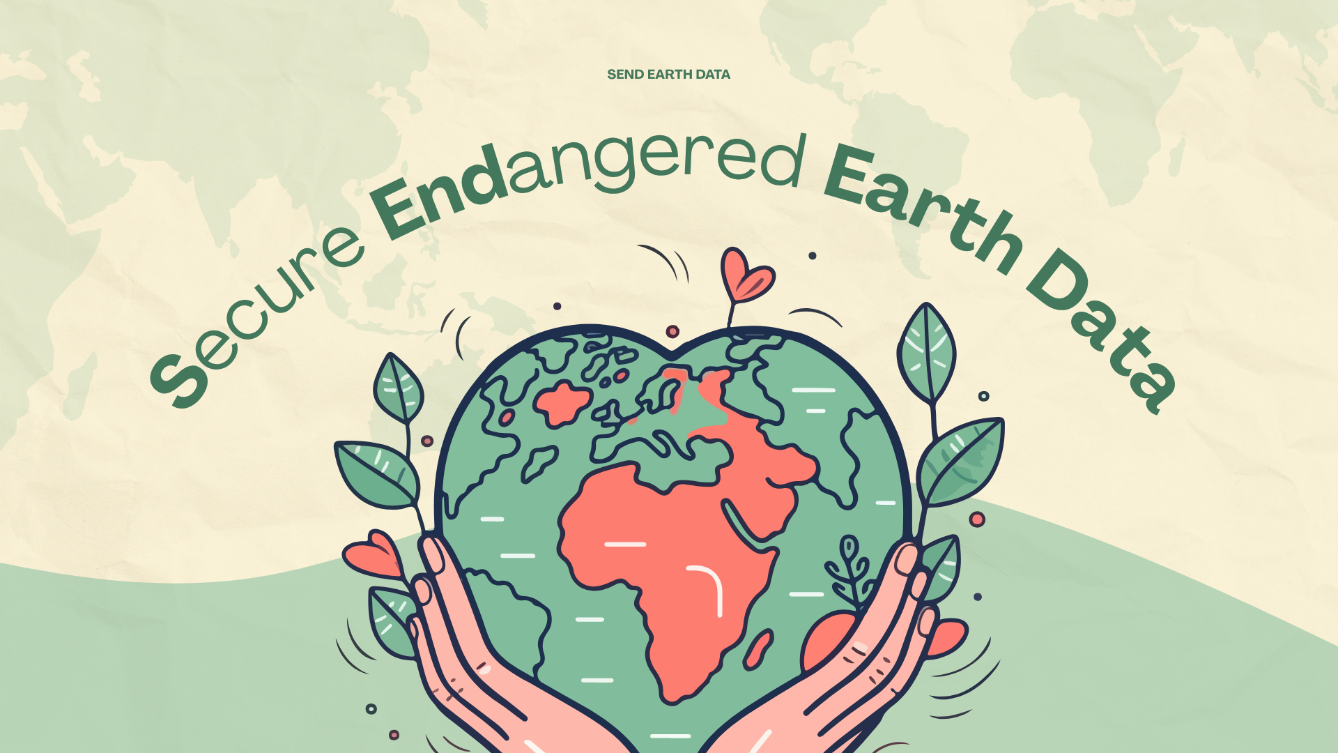
| Preserving Valuable Research Data: NFDI4Earth Supports Data Security in Earth System Sciences
| | NFDI4Earth is developing a strategy for the long-term preservation of valuable research data from Earth System Sciences (ESS). The German Research Foundation (DFG) is funding the collaborative project "Secure Endangered Earth Data - SEND Earth Data" over the next 18 months. The project focuses on safeguarding at-risk datasets to ensure their long-term availability and on developing practical measures for data security across all areas of ESS. It also aims to produce guidelines for resilient data infrastructures, formulate legal recommendations, and design a strategic roadmap for long-term data sovereignty. SEND Earth Data makes a significant contribution to securing scientific data for climate, environmental, biodiversity and solid Earth research, providing an essential basis for analyses, model development, and simulations of future scenarios.
The project builds on the existing structures of NFDI4Earth and will introduce a permanent national daisy chain of repositories for data resilience among the project partners, according to their scientific expertise -TU Dresden (TUD), the German Climate Computing Center (DKRZ), the Senckenberg Society for Natural Research, the GEOMAR Helmholtz Centre for Ocean Research, the GFZ Helmholtz Centre for Geosciences, the Helmholtz Centre for Environmental Research (UFZ), and the Alfred Wegener Institute, Helmholtz Centre for Polar and Marine Research (AWI). This will enable the rapid safeguarding of endangered datasets, close gaps in data processing, strengthen collaboration between national initiatives, and strategically embed them in the European and international landscape.
The NFDI4Earth Coordination Office (TU Dresden) & Valentina Protopopova-Kakar (GFZ, Potsdam) |
|
|---|
|
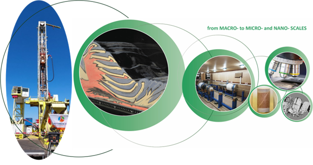
| | Join Europe’s Earth Science Labs Community
| | Photo credits: EPOS MSL
| The EPOS Multi-Scale Laboratories (MSL) is a network of about 120 state-of-the-art experimental and analytical laboratories and six data repositories across Europe, dedicated to solid Earth science. Connected under the umbrella of the EPOS ERIC (European Plate Observing System European Research Infrastructure Consortium), the EPOS MSL community aims to share research facilities and data pertaining to an impressive range of scales and disciplines: from micro-scale electron microscopy, geochemical analyses, and (paleo)magnetic investigations, to meter- and centimeter-scale high-pressure and high-temperature rock and fault mechanics, and analogue modeling, up to kilometer-scale geo-energy field measurements.
Since beginning of 2026, the EPOS MSL is co-chaired by Kirsten Elger, GFZ Data Services at the GFZ Helmholtz Centre for Geosciences, alongside colleague co-chairs Stephane Dominguez (CNRS) and Daniele Maestrelli (CNR-IGG). This year, the EPOS MSL Annual Meeting will be hosted in Potsdam, Germany, from 28 September to 2 October 2026.
Free of charge hybrid (on-line or in-person) participation is available on 29 September, offering an accessible entry point to learn about the network's scope, the process for joining, and what concrete benefits partaking in this community brings. Registration is required!
Who should attend?
The event offers an excellent opportunity for all Laboratory representatives across Germany, working in analog modeling, geological processing, geochemistry, microscopy, X-ray tomography, rock and melt physics, (paleo)magnetism, and field laboratories to participate in person.
We warmly encourage you to share this announcement with colleagues and laboratory teams who may be interested. We look forward to welcome you and to grow the EPOS MSL community in Germany.
Kirsten Elger, & Valentina Protopopova-Kakar (GFZ, Potsdam), Ronald Pijnenburg (Utrecht University), Stephane Dominguez (CNRS, Paris) & Daniele Maestrelli (CNR-IGG, Pisa)
| |
|
|---|
| | The NFDI4Earth project has been funded by the German Research Foundation (DFG) through the project NFDI4Earth (DFG project no. 460036893, https://nfdi4earth.de/) within the German National Research Data Infrastructure (NFDI, https://www.nfdi.de/). |
|
|---|
| NFDI Consortium Earth System Sciences | https://nfdi4earth.de
edited by: Valentina Protopopova-Kakar (GFZ Helmholtz Centre for Geosciences) & NFDI4Earth Coordination Office (TUD Dresden University of Technology)
Report news to: nfdi4earth-news@tu-dresden.de | |
|
|---|
|
|