| | Editorial
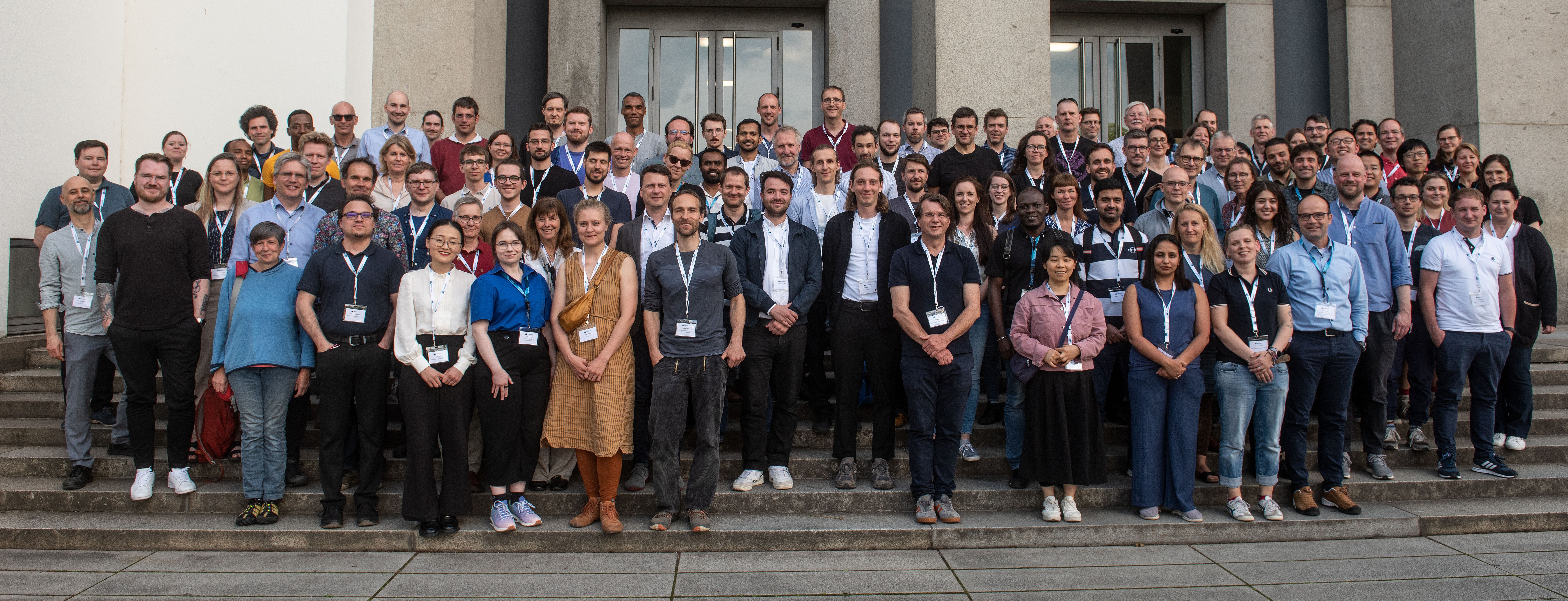
Dear reader, the end of this year – already the fourth year of our initialisation phase – once again offers an opportunity to look back for a moment and to express our gratitude for the efforts of all our members contributing to the development of the NFDI4Earth. The EGU General Assembly has been, and continues to be, an integral part of our activities – we will be there again in early May 2026. Another highlight was our joint back-to-back plenary with NFDI4Biodiversity at the end of September in Bremen, and, last but not least, we submitted our renewal proposal during the summer and defended it at the beginning of October.
We now have the last year of the first funding phase ahead of us, in the hope that we will be able to continue our work seamlessly from October 2026 onwards as the consortium for the Earth System Sciences within the NFDI. May the holiday season offer some time to relax and to "charge the batteries" for your individual and our common challenges in the upcoming year. For now, we wish all of you Merry Christmas and Happy Holidays as well as some relaxing days over the turn of the year, and are looking forward to continuing our collaborations in 2026 ...
Please enjoy our Holiday Newsletter 🎄🎆 !
The NFDI4Earth Newsletter Team |
|
| | | Meet us here Promoting NFDI4Earth in person at national and international conferences in spring 2026 NFDI4Earth @ EGU26 Save-the-Date NFDI4Earth Plenary 2026
Spot on... NFDI4Earth Quality Control via Connecting Reference Materials to GEOROC Geochemical Data
NFDI4Earth Outcomes Letter of Intent with umwelt.info NFDI4Earth Helpdesk: Question of the Quarter Harvesting Insights: The NFDI4Earth Academy Machine Learning Autumn Participate in NFDI4Earth Online course Foundations of Research Data Management for GIS Share Your Feedback and Shape the NFDI4Earth Report on Governmental Data
News from the RDM & Earth System Science Community Germany’s Path from Observer to Full EPOS Integration DIGIS and GEOROC support Digital Geochemistry for the Earth System Sciences
International News Uniting Europe’s Earth Science Labs in Connected Science Infrastructure | |
| | Promoting NFDI4Earth in person at national and international events in spring 2026 | NFDI4Earth aspires to further address the demands for digital changes in the German Earth System Sciences community. We aim to establish common principles, standards, and practices for research data management in Earth System Sciences and to build new prototypes and expand our distributed platforms, to provide improved tools and mechanisms for data integration and analysis.
Today, NFDI4Earth provides researchers with FAIR, coherent, and open access to all relevant Earth data, to innovative research data management, and data science methods. It is time to build closer relationships with the members of the diverse research community and all its sub-domains, across all fields and subjects of Earth System Sciences in Germany. That is why members of the consortium will be present at the following events in the first quarter of 2026. Event participants will have the opportunity to meet NFDI4Earth representatives and to learn more about our core products and services.
January
15 January 2026: NIAM 2026, Berlin & Online
| | Picture Credit: NIAM 2026, German Society for Cartography (Die Deutsche Gesellschaft für Kartographie e.V. - DGfK)
| |
| | 17 – 19 February 2026: CDRmare General Assembly, Berlin
| | Picture Credit: CDRmare 2026
| The CDRmare General Assembly 2026 will be held at the Seminaris Campus Hotel, Berlin. Marine-based Carbon Dioxide Removal (CDRmare) is one research mission of the German Marine Research Alliance (DAM) “Marine carbon sinks in decarbonisation pathways”. A CDRmare Early Career Scientist Workshop is organized just before the General Assembly. |
| 24 February 2026: Celebration of 100 years German Soil Science Society, Hannover
| | Picture Credit: 100 Jahre DGB, German Soil Science Society (Deutsche Bodenkundliche Gesellschaft e. V.)
| The German Soil Science Society - a network of individuals and institutions involved in soil science and its diverse fields of application - will celebrate its 100th anniversary at the Federal Institute for Geosciences and Natural Resources (BGR) in Hannover. The programme will provide top-class lectures and musical accompaniment by a quintet from the orchestra of Leibniz University Hannover. |
| 24 – 25 February 2026: RDA Germany Conference 2026, Potsdam | | Picture Credit: RDA Germany Conference 2026, RDA community in Germany (RDA Deutschland e.V. - RDA DE e.V.) | The RDA community in Germany aims to increase data exchange and make data reuse more efficient. It comprises data experts in Germany who are involved in the Research Data Alliance (RDA) or have an interest in the RDA's results. RDA-DE meet once a year at the GFZ in Potsdam, where the general meeting of RDA Deutschland e. V. is also held. |
| | 1 – 5 March 2026: 86th DGG Annual Meeting, Münster |
|
| Picture Credit: 86th DGG Annual Meeting,
German Geophysical Society
(Deutsche Geophysikalische Gesellschaft e.V.DGG) |
| |
|---|
| 4 – 6 March 2026: Hydrology Day 2026, Kassel | | The 2026 Hydrology Day of the German Hydrological Society will be held at the University of Kassel on water resources under pressure - the impact of global change on water availability and water quality is dedicated to the improvement of the resilience of the landscape water balance, taking into account the combined effects of climate and land-use change. |
| 25 – 27 March: 46th Scientific & Technical Annual Conference of DGPF, Darmstadt
| | Picture Credit: German Society for Photogrammetry, Remote Sensing and Geoinformation
(Deutsche Gesellschaft für Photogrammetrie, Fernerkundung und Geoinformation e.V. - DGPF
| |
| International activities and events |
|
|---|
16 – 20 March 2026: EPOS Days 2026 Cagliari, Sardinia, Italy
| | Picture Credit: EPOS Days 2026 |
| |
|---|
An extended list with conferences and events focusing on NFDI4Earth, on Earth System Sciences and/or research data management can be found on the NFDI4Earth webpage. Valentina Protopopova-Kakar (GFZ Potsdam), Daniel Nüst & Jörg Seegert (both TUD Dresden University)
| | | | Picture Credit: Coortination Office (TUD Dresden University) |
After the big success of the EGU 2024 and 2025, NFDI4Earth will again join next year's EGU General Assembly taking place from 3 to 8 May 2026 in Vienna, Austria.
Again, we will share a cluster of booths (#23, #24 & #25) of different partners, e.g., the German Climate Computing Center (DKRZ), Hamburg, and the Leibniz Supercomputing Centre (LRZ), Munich, perfectly located in the main entrance hall of the conference venue.
We are planning a Townhall Meeting together with our partner Data Terra, a research infrastructure dedicated to Earth observation data in France, and other European initiatives. As usual, NFDI4Earth members will contribute to the event with various co-organized sessions in the context of NFDI4Earth:
We would like to ask you to submit an abstract before 15 Jan 2026, 13:00 CET or will be happy if you simply attend the following sessions:
Co-organized with Data Terra:
· ESSI2.6: Shaping the European landscape for Earth System Science – Making transnational data use of research infrastructures Co-organized with LifeWatch ERIC:
· ESSI4.2: From Data Silos to Data Spaces: How FAIR Digital Objects Transform Research In NFDI4Earth scope: · ESSI2.7: Workflow approaches enabling scalable and reproducible state-of-the-art computation and data analysis in Earth System Sciences · ESSI3.1: Open Science Enterprise: A Blueprint for Collaborative Platforms · ESSI3.3: Research data infrastructures in Earth System Sciences: Bridging the gap between user needs and sustainable software solutions; linking approaches across disciplines and domains · ESSI4.6: Modern Earth system science visualization and exploration techniques - the balancing act between complex information, broad functionality and simple illustration
· ESSI5.1: Open Session for Earth and Space Science Informatics · SC2.19: Discover data, repositories and learning materials - advance your research by using open ESS services
Christin Henzen, Jörg Seegert (TUD Dresden University of Technology) & Valentina Protopopova-Kakar (GFZ Potsdam)
|
|
|---|
| Save-the-Date: NFDI4Earth Plenary 2026
| | Picture Credit: Coortination Office (TUD Dresden University) |
Please save the date for our 5th NFDI4Earth Plenary taking place from 27 to 29 May 2026 again at the Deutsches Hygiene-Museum Dresden - Lingnerplatz 1, Dresden. We will start on Wednesday, 27 May 2026, with workshops and side events, followed by talks, hands-on sessions, workshops, and external impulses on Thursday and Friday.
Further details on the Plenary, in particular the programme and schedule, will follow next year. We look forward to welcoming you back to Dresden at the end of May 2026!
The NFDI4Earth Coordination Office (TUD Dresden University of Technology) | |
| | Quality Control via Connecting Reference Materials to GEOROC Geochemical Data
| For more than a quarter of a century, the GEOROC database (Geochemistry of Rocks of the Oceans and Continents) and GeoReM database (Geological and Environmental Reference Materials) have served the global geochemical and geoanalytical research communities. The GEOROC database is hosted at the Georg-August-Universität Göttingen by the DIGIS-Project (Digital Geochemical Infrastructure) and provides free access to published geochemical analyses of igneous rocks and minerals. GeoReM is internationally regarded as the leading resource for geological and environmental reference materials complete with metadata. | | Connecting GeoReM and GEOROC (figure above) forms the foundation for an NFDI4Earth-funded pilot project jointly led by DIGIS and the International Association of Geoanalysts (IAG). GeoReM was relocated from the Max-Planck-Society to the IAG, which ensures the data curation and long-term sustainability. DIGIS provides the technical development, bringing GEOROC and GeoReM together in a modern and interoperable IT infrastructure.
Within this framework, our NFDI4Earth pilot currently aims to address a long-standing difficulty of evaluating the analytical quality of data compiled from different laboratories, methods and studies. The project is developing adaptable statistical and machine learning data-quality evaluation tools that uses the complementary strengths of GEOROC’s compositional data holdings and GeoReM’s extensive reference materials and metadata. One tool screens rare Earth element pattern to identify typographical errors, and other tools that assess outliers and inter-study bias based on metadata and reference materials.
The combined achievements underscore how coordinated efforts in data curation, metadata harmonization, and open infrastructure development can significantly enhance the value of domain-specific synthesis databases.
Dieter Garbe-Schönberg (IAG), Leander Kallas (DIGIS, University of Göttingen), Axel D. Renno (IAG), Marie Traun, Matthias Willbold & Gerhard Wörner (DIGIS, University of Göttingen) | |
| |
|
|---|
| Picture Credit: Nicepage Joomla Extension |
| NFDI4Earth and umwelt.info sign letter of intent | At this year's fall meeting of the umwelt.info advisory board, a Letter of Intent was signed between NFDI4Earth, alongside NFDI4Biodiversity and the Helmholtz Metadata Collaboration representing science, and umwelt.info and its related National Centre for Environmental and Nature Conservation Information on a closer exchange and cooperation to strengthen the network between scientific and governmental institutions in the environmental sector. |
|
|---|
The National Centre for Environmental and Nature Conservation Information is a branch office of the Federal Environment Agency located at Merseburg. The centre is responsible for setting up and operating the web portal umwelt.info. The portal will develop into the primary point of contact for data and information on the environment and nature conservation in Germany.
The two signatories, Anja Reineke, Head of umwelt.info, and Jörg Seegert, Managing Director of NFDI4Earth, are placing the joint cooperation on a new footing. Impulses from science can now flow into the development of umwelt.info from further perspectives and vice versa, whereby exchange has already been established at various levels: best practices of metadata, establishment of interfaces between the respective technical infrastructures of the partners, promoting the FAIR principles as well as networking between scientific and governmental institutions in the field of environmental protection and nature conservation..
Christin Henzen & Jörg Seegert (TUD Dresden University of Technology)
| |
|
|---|
NFDI4Earth Helpdesk: Question of the Quarter |
| |
|---|
The User Support Network Helpdesk answers the questions we get in the internal ticket system. To give you an impression of our work, we will regularly present some of our answers here.
Question: What are the possibilities to allow external users to use a newly developed data service app? Are there data protection restrictions when hosting the service, and how can we offer it for local use?
Answer: We asked an expert for research software development to help us with this question.
Regarding the data privacy concerns, most organizations have established a process to deal with these use cases. The GDPR (counterpart to German DSGVO) requires you to state what data you are collecting from your users, to what purpose, who is responsible, and whom to contact in case of inquiries. Your institution probably has a template that can be used as a starting point, and people who can offer advice (e.g., the team responsible for your institution's website).
Regarding the copyright and data privacy of data published by others using your service, there have to be defined terms of use to be accepted by the user. Usually you can lean on the terms already in place for other apps of your institution.
In summary, it would be beneficial to include a data privacy statement, an imprint and terms of use to your service. Additionally, you should contact and work together with the responsible parties at the organization hosting the app, since at the end of the day, they will have to accept the remaining legal risks after all these measures.
Instead of hosting the service, you can publish the software with a suitable license in a software repository. This allows the user to download and use it locally.
Hela Mehrtens & Klaus Getzlaff (GEOMAR Kiel)
| | Harvesting Insights: The NFDI4Earth Academy Machine Learning Autumn
|
|
|---|
| NFDI4Earth Academy Winterschool Fellows. Picture Credit: Inge Wiekenkamp (GFZ Potsdam) |
| In October and November, the NFDI4Earth Academy focused on machine learning through four open "Virtual Coffee" lectures, attracting between 21 and 85 participants per session and 199 attendances in total. The lectures unpacked the basics of ML, walked through typical workflows, and spotlighted real-world use cases in geoscience and industry. All lectures were very well received, with lively Q&A and active engagement from the audience. Thanks to everyone who joined the conversation and to our speakers Sonja Hänzelmann (AWI), Susana Simancas Giraldo (AWI), and Artemii Novoselov (Stripe).
From 12 to 14 November 2026, our 2nd Academy cohort met at the International Maritime Museum Hamburg for the NFDI4Earth Academy Winter School. The focus: a collaborative ML hackathon using an air quality dataset, plus a hands-on workshop on Explainable AI by Mike Sips (GFZ) and two keynote lectures by Johannes Meuer (DKRZ) and Zahra Zali (GFZ). Fellows worked in teams through the full data science lifecycle, compared different modelling strategies, and discussed how to transfer the resulting workflows to their own geoscientific use cases.
Jonas Kuppler (GFZ Potsdam & Geo.X) |
|
|---|
|
| Participate in… NFDI4Earth |
|
|---|
Online course on Foundations of Research Data Management for GIS
| Registration is now open for the upcoming online course about Foundations of Research Data Management for GIS (starting 5 February 2026).
This hands-on course introduces essential Research Data Management (RDM) practices tailored for GIS workflows in the Earth Systems Sciences community. Whether you work with satellite data, environmental models, or field observations, you’ll learn how to manage, organize, and share spatial data more efficiently and reproducibly. |
| | Picture Credit: Digital Research Academy |
|
|---|
Through a mix of short self-paced modules and five weekly one-hour interactive sessions between 5 February and 5 March 2026, participants will explore practical strategies for: - streamlining GIS data processes
- improving collaboration in research teams
- applying FAIR principles to real-world spatial datasets
- avoiding common pitfalls in geospatial data management
The course is developed and delivered by expert GIS trainer Dr. Nick Bearman, with support from RDM specialists at the Digital Research Academy. All self-paced materials are developed during the NFDI4Earth EduPilot in 2025 and are hosted on the NFDI4Earth Education Portal, where you can work through the content at your own pace.
If you’d like to join the instructor-led cohort, please sign up by 31 January 2026.
Joyce Kao & Nick Bearman (Digital Research Academy)
| |
|
|---|
| Picture Credit: Peggy & Marco Lachmann-Anke on Pixabay |
| Share Your Feedback and Shape an NFDI4Earth Report on Governmental Data
| The Report on data made available for research by governmental authorities (D2.3.1) explores how governmental ESS datasets are published, how researchers can find and access them, and what is required for a sustainable end-to-end data pipeline.
We invite you to take an active role and share your feedback by 15 February 2026. Your insights will directly influence the next version of the report (D2.3.2) and help ensure it truly meets the needs of the research community. |
|
|---|
Please focus on: - Usable insights: Which recommendations can you apply in your work right away?
- Practical relevance: Do the guidance on portals, metadata, and workflows match your real experience?
- End-to-end pipeline: Where do challenges occur between data publication and use, and what should the next version improve?
Submit your feedback using the User Support form (Please set Subject to "D2.3.1" and Category to "Information and Metadata"). Thank you for participating! Your input will help make the report more useful and ensure that future ESS services better support the community.
Astrid Ziemann (TUD Dresden University of Technology) | |
| News from the RDM & Earth System Science Community | Germany’s Path from Observer to Full EPOS Integration
| The European Plate Observing System (EPOS) is a European Research Infrastructure Consortium (ERIC) focusing on solid Earth science. It aims to provide a unified access point to data, data products, and services to help scientists better understand Earth processes.
| | Andrey Babeyko (GFZ Potsdam) Thematik Core Service Tsunami, Photo Credit:Jörn Behrens (University of Hamburg) | Why is EPOS Membership Important for German Researchers?
EPOS membership offers strategic, scientific, and economic benefits for both Germany and its research community. It connects laboratories, data centers, and observatories to a European, large-scale, interoperable research infrastructure and shows national commitment to scientific collaboration. It provides a share of the financial and operational costs and ensures efficient management of scientific and technical resources.
Membership gives voting rights, that ensures German priorities and gives an advantage in major European funding calls (e.g., Horizon Europe). International Research Infrastructures support the scientific understanding of natural hazards, geo-resources, geothermal energy, etc. and provide the opportunity to conduct cross-disciplinary, complex projects, through access to high-quality data, state-of-the-are research facilities and services. Researchers are able to preserve valuable project outcomes, increase their citation potential and benefit from networking and training opportunities.
Building EPOS-DE Community
Germany has played a key role in EPOS development since the late 90’s. However, its current Observer status limits national influence, despite significant contributions of data and services. To strengthen national engagement and progress toward full membership, the workshop “EPOS-DE: Building the Community” was held on 28 November at the GFZ Helmholtz Centre for Geosciences in Potsdam, with representatives of NFDI4Earth contributing a spotlight presentation and participating in the discussion.
Researchers and institutions interested in joining the follow-up activities are invited to contact the German EPOS representative, Prof. Frederik Tilmann.
Valentina Protopopova-Kakar & Frederik Tilmann (GFZ Potsdam)
| | DIGIS and GEOROC support Digital Geochemistry for the Earth System Sciences
| Since 2021, the GEOROC database is hosted at the Georg-August-Universität Göttingen by the DIGIS-Project (Digital Geochemical Infrastructure). GEOROC provides access to geochemical analyses of igneous rocks and minerals. Thes database contains major and trace element values, isotope ratios, geochronological ages as well as metadata describing locations, samples, and analytical methods (see figure below). | | GEOROC data holdings of about 700.000 samples with rock and mineral analyses, 40.7 Million individual values from >23.000 publications
| From 2021 to 2025, DIGIS secured the 25-year-old GEOROC database through migration to a new IT infrastructure and now provides a geochemical data repository in collaboration with GFZ Data Services. DIGIS re-established GEOROC’s connection to the EarthChem Portal and contributes to the international OneGeochemistry initiative. A redesigned GEOROC web interface for flexible query options and improved visualizations will go online in 2026.
Under the umbrella of OneGeochemistry, DIGIS-2 (funding phase 2025–2028) aims at establishing data standards and machine-readable controlled vocabularies for location, sampling, lithology, minerals, tectonic setting, as well as analytes, analytical methods, and reference materials for interoperability between data sets from geochemistry, cosmochemistry, and environmental sciences. Another focus is on data quality assessment tools. DIGIS-2 will also integrate machine learning and AI for information extraction and curation employing vision-language models, computer vision, and natural language processing to aid consistent data quality standards for curation.
DIGIS is supported by the German Research Foundation (DFG) and by the NFDI4Earth Pilot project. Additional support comes from the Göttingen State and University Library, and GWDG data services. The Geoscience Center Göttingen contribute IT support, new IT hardware, and a permanent data scientist position after 2028.
Bela Gipp (SUB Göttingen), Leander Kallas (University of Göttingen), Daniel Kurzawe (SUB Göttingen), Marie Traun, Matthias Willbold & Gerhard Wörner (University of Göttingen) | |
|
|---|
| | Uniting Europe’s Earth Science Labs in Connected Science Infrastructure | The EPOS Multi-Scale Laboratories (MSL) community - a network of leading European laboratories dedicated to solid Earth science - held its annual meeting in Montpellier, France, from 17 to 19 November 2025. This year, NFDI4Earth had the opportunity to participate in the discussions. MSL operates as a Thematic Core Service (TCS) within the multidisciplinary European Plate Observing System (EPOS), an ERIC (European Research Infrastructure Consortium) that provides integrated data and services for the solid Earth sciences. | | EPOS MSL Annual meeting in Planet Ocean Montpellier, France. Photo Credit: Stephane Dominguez (CNRS DataTerra) | What is MSL? The EPOS MSL community brings together 120 state-of-the-art experimental and analytical laboratories across Europe. Their research spans an impressive range of scales: from kilometer-scale geo-energy field measurements, to meter- and centimeter-scale high-pressure and high-temperature rock and fault mechanics, rock physics, and analogue modeling, down to micro-scale electron microscopy, geochemical analyses, and (paleo)magnetic investigations.
How does MSL help you?
Laboratories, repositories, and researchers are warmly invited to join the network and benefit from the full capabilities of EPOS MSL. Participating laboratories can showcase their research outputs, equipment, and expertise, significantly increasing their visibility. Data repositories can enhance interoperability and feature their catalogues on the EPOS data portal alongside other European Solid Earth datasets. Researchers gain visibility and citation potential by publishing data in partner repositories, ensuring their outputs are findable, accessible, interoperable, and reusable (FAIR), while also sharing and preserving project-related services.
Importantly, including an ERIC, such as EPOS ERIC, as a partner in future project proposals is increasingly becoming a requirement in European funding calls, including Horizon Europe.
The next MSL Community Meeting will take place in autumn 2026 at the GFZ Helmholtz Centre for Geosciences in Potsdam, Germany.
Valentina Protopopova-Kakar & Kirsten Elger (GFZ Potsdam), Ronald Pijnenburg (Utrecht University) & Corrado Cimarelli (LMU Munich) |
|
|---|
| | The NFDI4Earth project has been funded by the German Research Foundation (DFG) through the project NFDI4Earth (DFG project no. 460036893, https://nfdi4earth.de/) within the German National Research Data Infrastructure (NFDI, https://www.nfdi.de/). |
|
|---|
| NFDI Consortium Earth System Sciences | https://nfdi4earth.de
edited by: Valentina Protopopova-Kakar (GFZ Helmholtz Centre for Geosciences) & NFDI4Earth Coordination Office (TUD Dresden University of Technology)
Report news to: nfdi4earth-news@tu-dresden.de | |
|
|---|
|
|