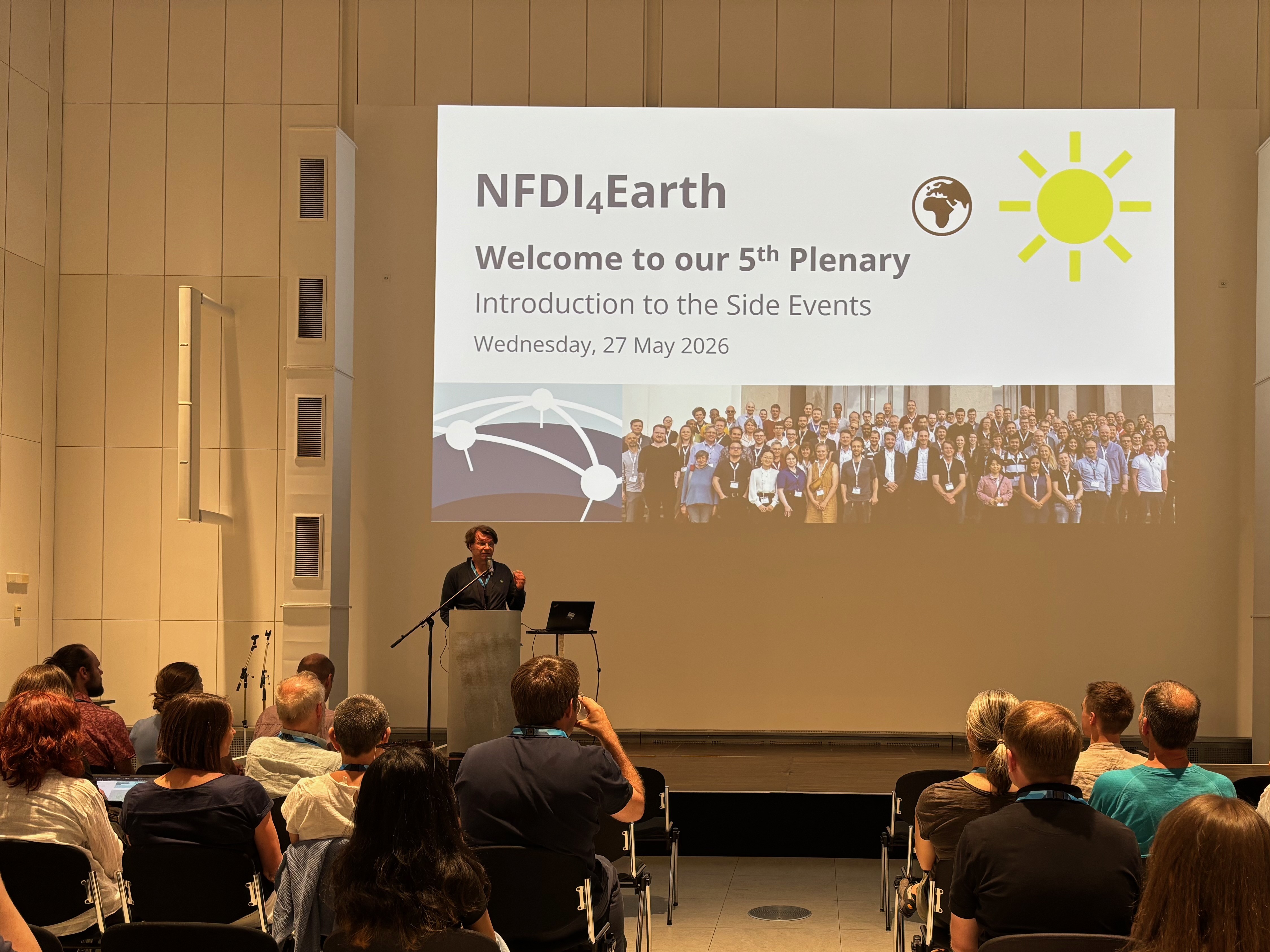
Thank you very much for an exciting and productive NFDI4Earth Plenary!
You can find an overview of our products and activities from the first funding phase here .
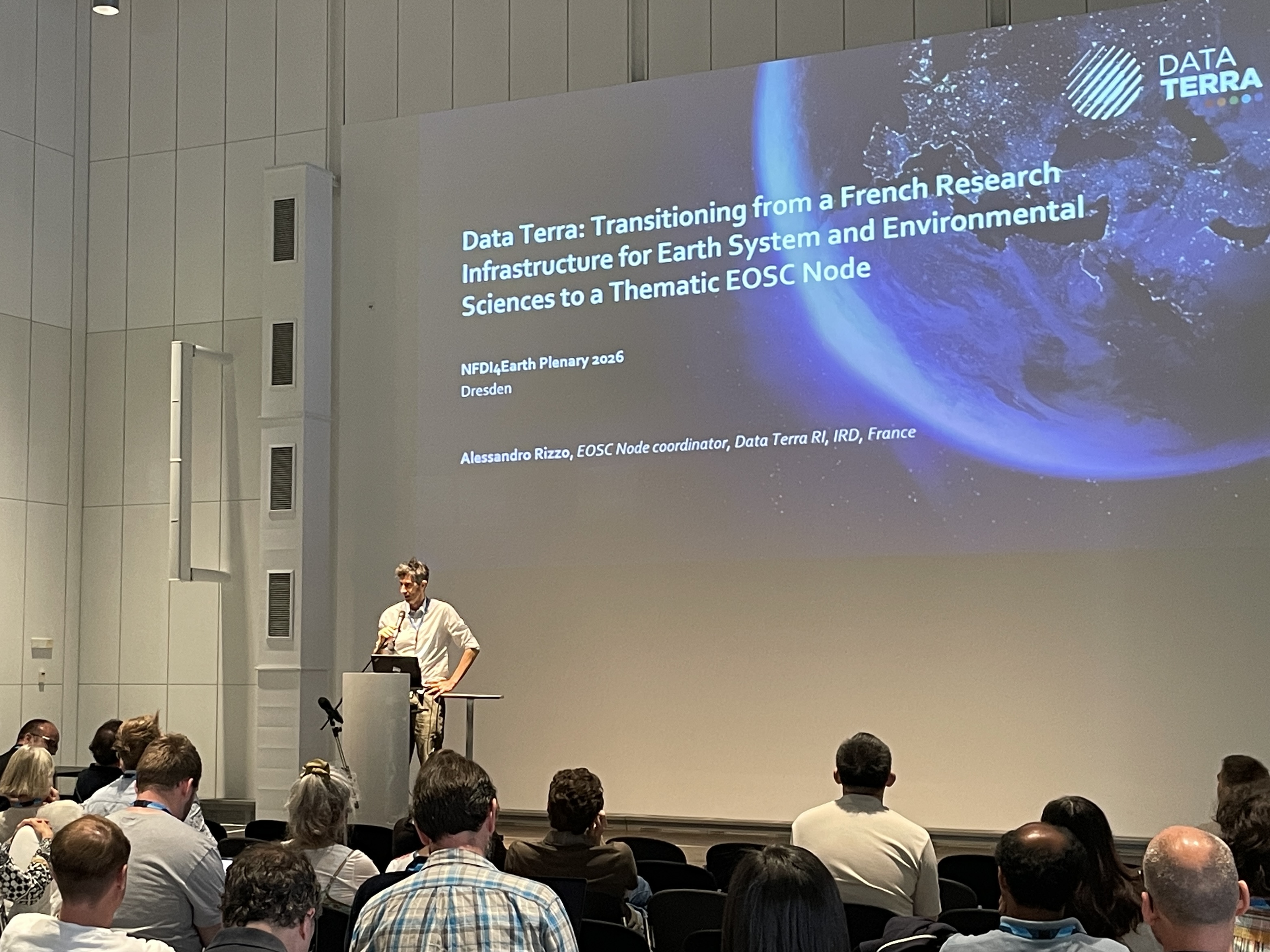
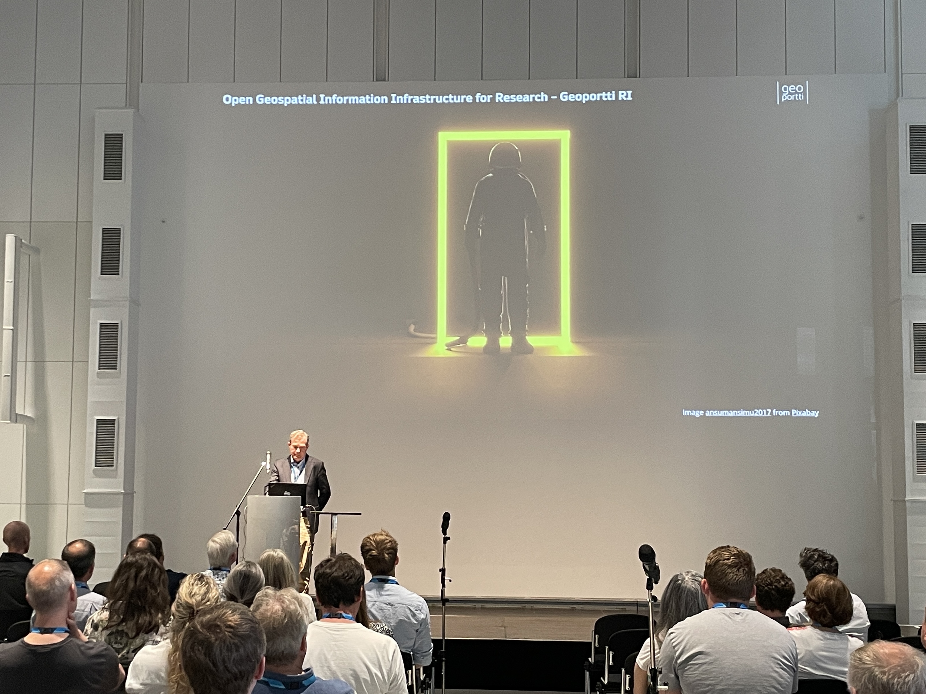
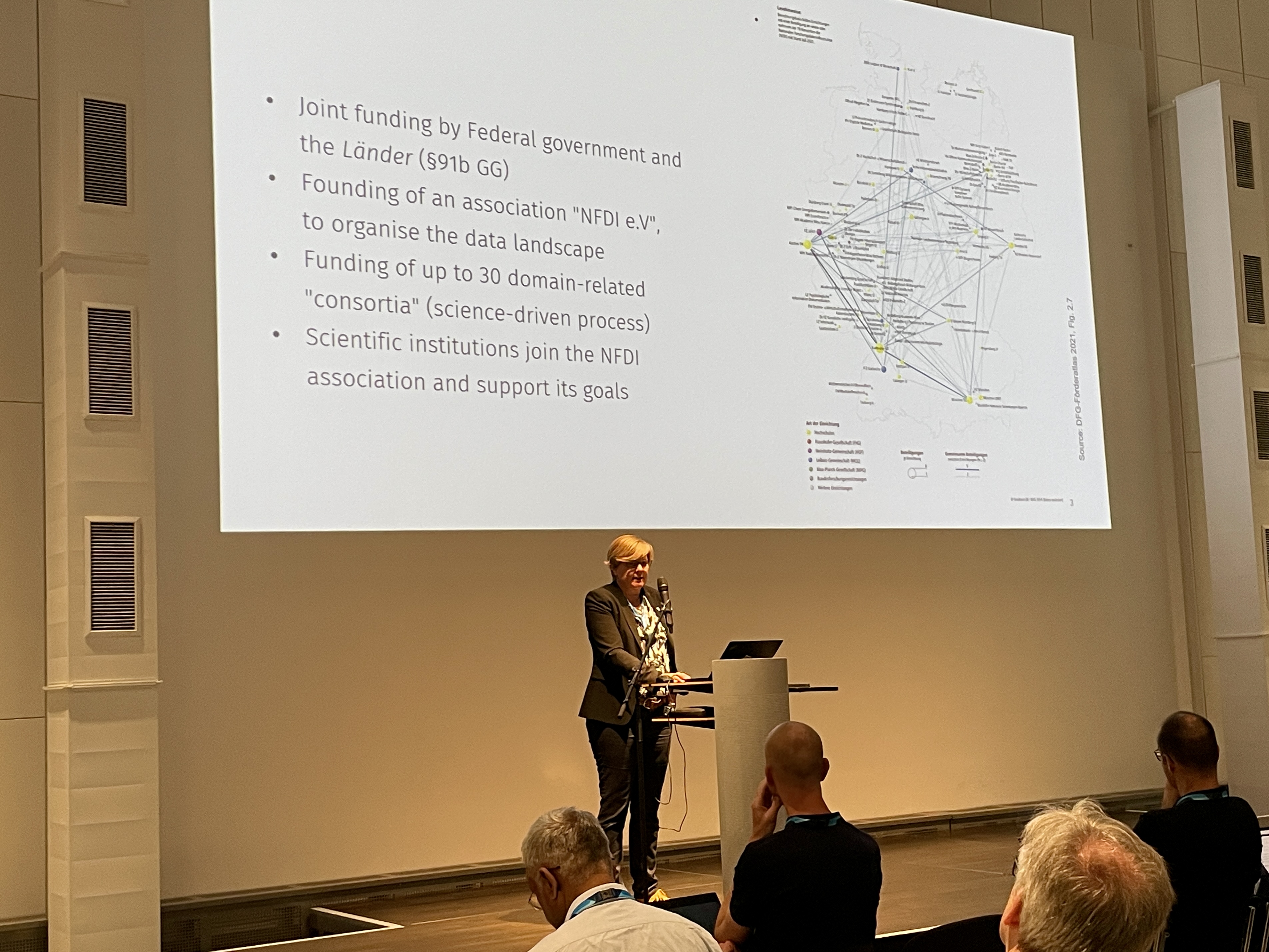
A selection of the posters presented at the Plenary has already been uploaded to our NFDI4Earth Zenodo community . We would also like to thank our keynote speakers Alessandro Rizzo , Juha Oksanen and Barbara Ebert , who kindly made their presentations available.
| 08:30 |
Official Registration (Foyer) |
| 09:00 - 09:15 | Welcome / Lars Bernard (Marta Fraenkel hall) |
| 09:15 - 10:00 | Pitching Products and Services of the First Funding Phase / Jörg Seegert (MF hall)
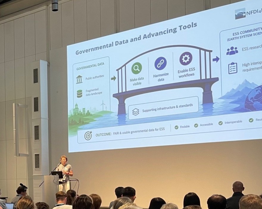
Slides Academy (Jonas Kuppler) EduTrain (Carsten Keßler) OneStop4All (Christin Henzen) Living Handbook (Dominik Hezel) User Support Network (Hela Mehrtens) Governmental Data and Advancing Tools (Astrid Ziemann) Service Management und Architecture (Claudia Müller) Label und Knowledge Hub (Ronny Gey, Anna Brauer) Commitment (Daniel Nüst) |
| 10:00 - 11:00 | Earth
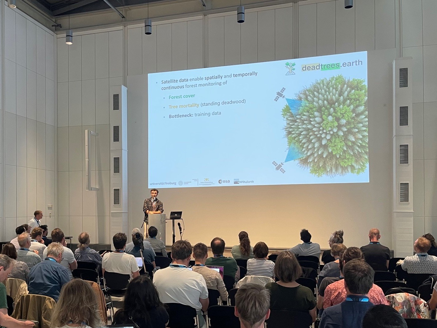
System Sciences Use Cases – Pilots and Beyond I / Udo Feuerhake, Kolja Nenoff (MF hall) German Marine Seismic Data Access (Janine Berndt) GeoFresh (Sami Domisch) CAMELS-DE: Hydrological datasets from and for the community (Alexander Dolich) Deadtrees.earth: A community driven infrastructure for tree mortality monitoring from local to global scales (Kilian Gerberding) |
| 11:00 - 11:30 | Coffee Break (Foyer) |
| 11:30 - 12:15 | Earth
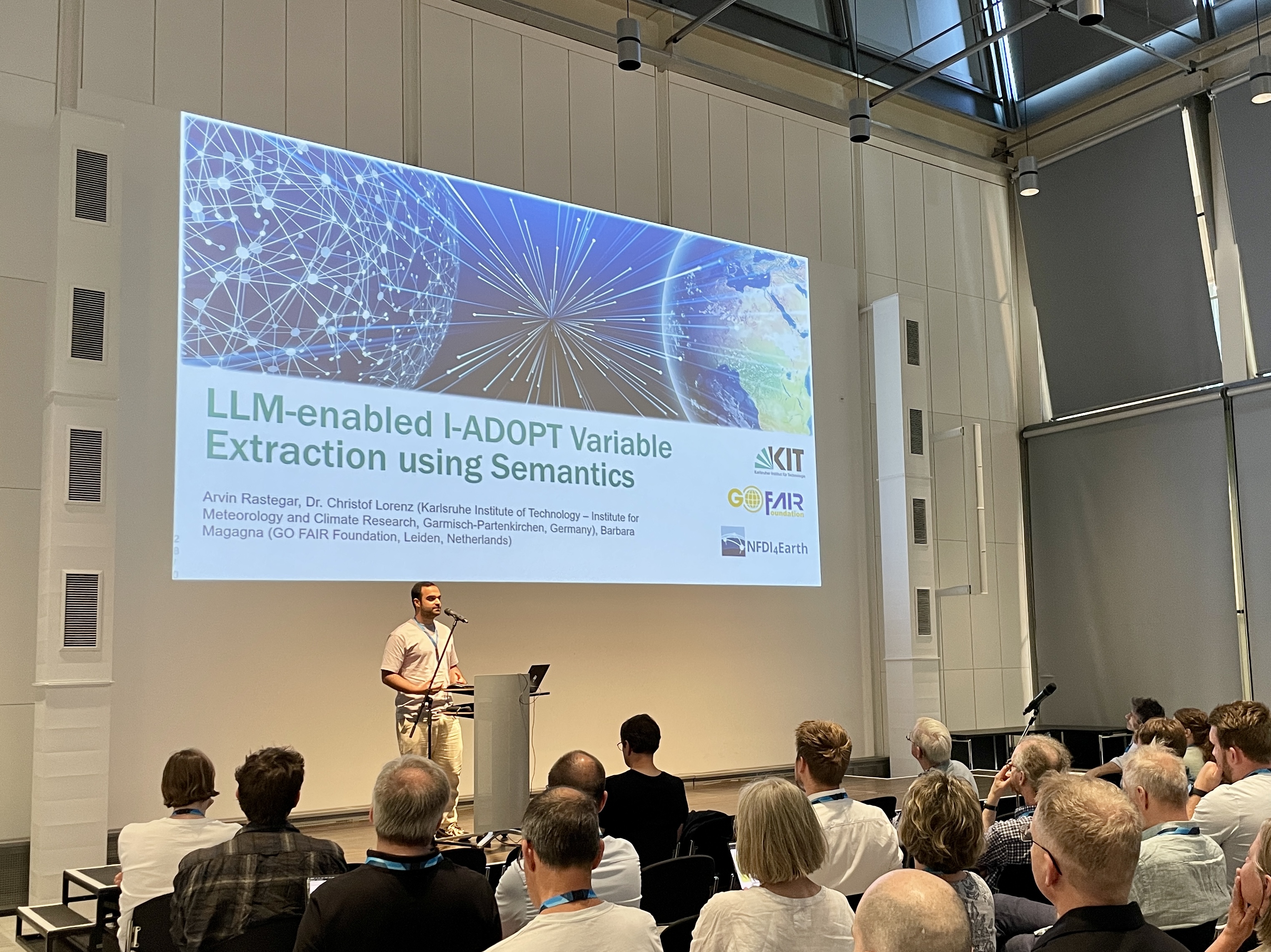
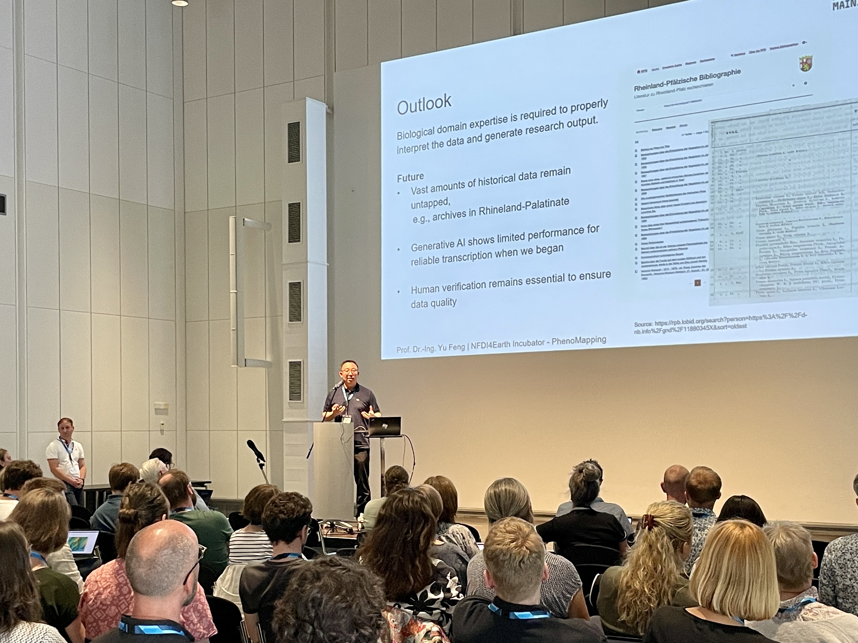
System Science Use Cases – Pilots and Beyond II / Udo Feuerhake, Kolja Nenoff (MF hall) World settlement portal and EOC Data Portal (Jan-Karl Haug) PhenoMapping - A participatory visual tool for curation and verification of historical phenological data (Yu Feng) LLM-enabled I-ADOPT Variable Extraction using Semantics (Arvin Rastegar) Unlocking Multifunctional Insights with Near Surface Geophysical Data Harmonization (Ulrike Werban) |
| 12:15 - 12:30 | Pitching the Workshops / Jörg Seegert (MF hall) |
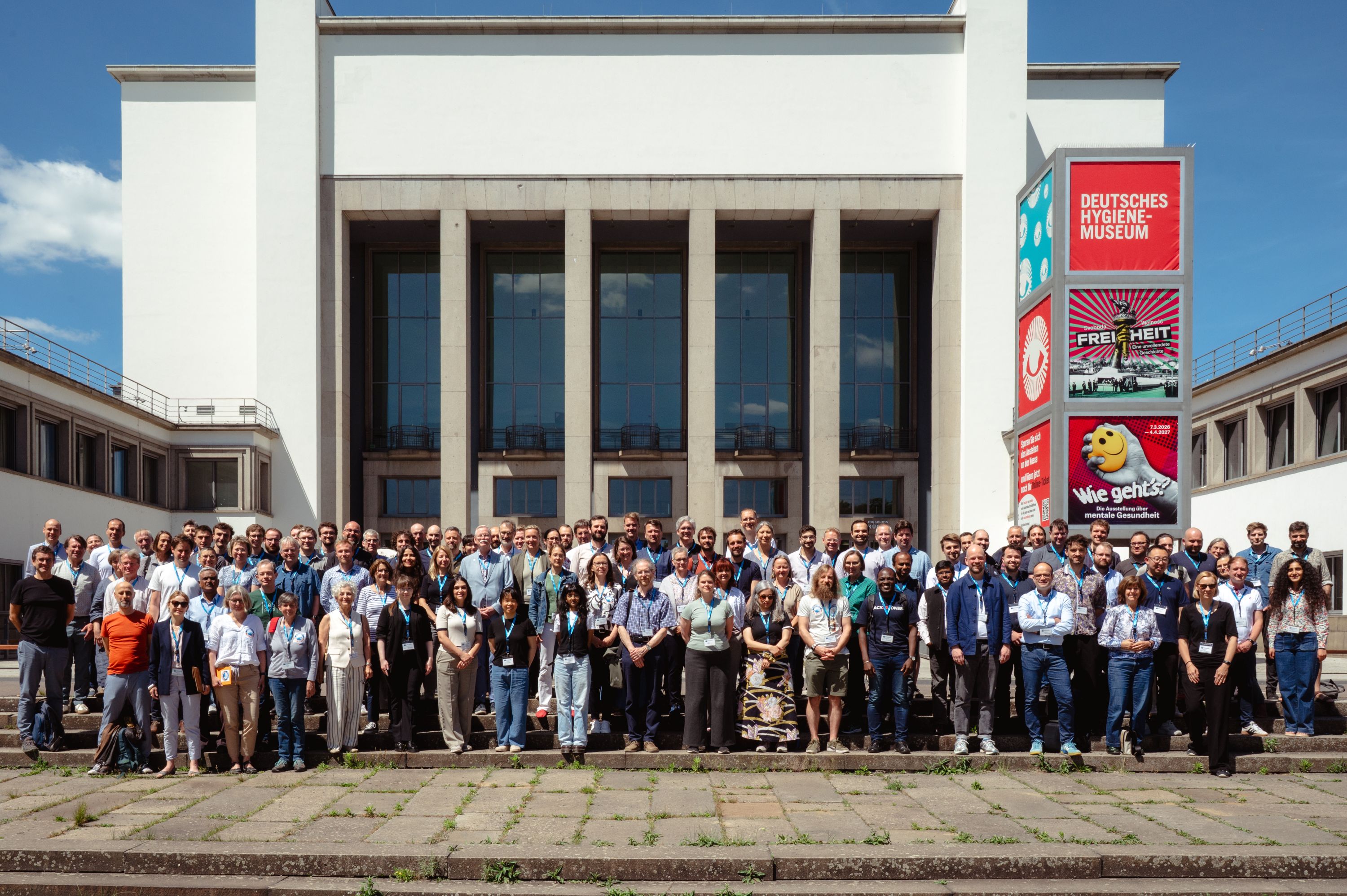
| 12:30 | Group picture |
| 12:30 - 13:30 | Lunch (Foyer) |
| 13:30 - 15:00 | Workshops
- AI use in Earth System Sciences (Marta Fraenkel Hall) - Ten Months of NFDI4Earth Label: Adoption, Lessons Learned, and Future Directions (Room 2) - NFDI4Earth Living Handbook - from the past to the future (Room 3) - Shaping the interaction between the future Lighthouse Use Cases and NFDI4Earth (Room 4) - Synergies in Service (Information) Management (Room 9) |
| 15:00 - 16:00 |
Coffee Break / Setup Poster and Software Marketplace (Foyer)
|
| 16:00 - 18:00 | Software
Marketplace (Room 2)
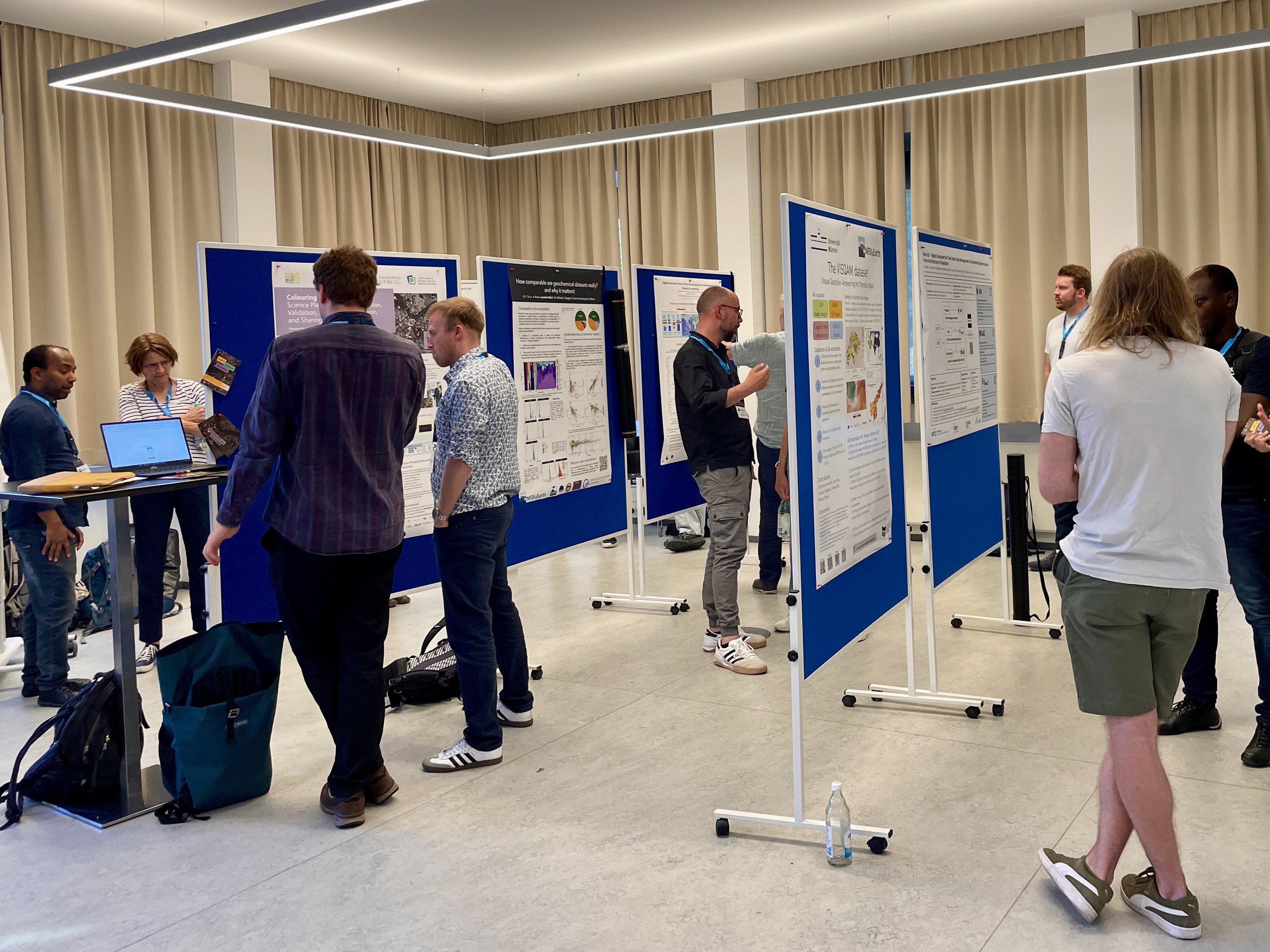
Poster Presentations (MF hall & Foyer / Room 1) |
| 18:30 - 22:00 |
Dinner
|
Workshops on Wednesday
Water Science & Hydro Use Cases – GeoFRESH Hands-on
Sami Domisch (sami.domisch@igb-berlin.de), Jörg Seegert (joerg.seegert@tu-dresden.de)
Performing analyses on river networks can be challenging given the up- and downstream con-nectivity. Graph-based river networks are a promising avenue and provide an instrument for water research that can be employed globally in order to investigate e. g. the effects of built ob-stacles such as dams and weirs, which interrupt river networks and are barriers to migrating species. In our workshop, we will show various tools that can be used to perform river network computations directly on a server, which hosts a detailed global network of rivers and streams represented as a graph. In addition, we will show how to perform complex computations such as finding the upstream catchment area of a particular point, the downstream paths along the net-work all the way to the river outlet, or distances between two points along the river network (“as the fish swims”). We will introduce the river network dataset and the various tools, explain their usage, and provide an example analysis of river connectivity. Participants can use their own laptops if they have pre-installed the necessary packages, or follow the workshop using a pro-vided Jupyter Notebook.
BITS & Pieces - Exploring Semantic Tools in Earth System Science
Anette Ganske (Anette.Ganske@tib.eu), Andrea Lammert, Alexander Wolodkin
Drop by and connect with the people behind BITS (Blueprints for the Integration of Terminology Services in Earth System Sciences) and the wider community we’ve collaborated with along the way. This booth is a relaxed space to explore what we’ve built, exchange ideas, and catch up with familiar faces - or meet new ones. We’ll showcase our blueprints, posters, and project outcomes, and share practical insights into integrating terminology services into real-world research data workflows. So whether you’re curious about semantic interoperability, looking for collaboration opportunities, or just want to chat, you’re very welcome to stop by. Enjoy some refreshment, say hello and be part of the conversation. We´re looking forward to meeting you!
RDMO Earth-Sensor: A tool tailored to create data management plans for observation based research projects
Corinna Rebmann (corinna.rebmann@kit.edu), Bjarne Biskamp (bjarne.biskamp@ufz.de)
The Research Data Management Organiser (RDMO) supports research projects in the planning, implementation and administration of all research data management tasks. The Earth-Sensor catalogue supports features relevant for research projects that acquire observation data during field campaigns and long-term monitoring sites in earth-system sciences (ESS) as an instance hosted by NFDI4Earth. The Earth-Sensor RDMO catalogue will provide a user-friendly, interoperable solution for creating high-quality DMPs and support cross-institutional workflows. It is configured to enable harvesting sensor related metadata from the sensor management systems SMS and O2A-registry to allow users convenient dealing with metadata including their transfer to project related publications. The workshop will give an overview of the newly developed catalogue features. During the workshop, we will practice with the participants how to fill the DMP and gather feedback to further improve the catalogue’s usability.
FAIR scientific knowledge with the TIB Knowledge Loom
Markus Stocker (markus.stocker@tib.eu)
The TIB Knowledge Loom (https://knowledgeloom.tib.eu/) is a novel open science digital library of FAIR scientific knowledge, i.e., research findings and supporting data. The workshop will introduce to the Loom, explain how researchers in Earth system sciences can contribute, and how the Loom in return can support data, code, and reproducibility statements in research articles. The workshop will also demonstrate how the Loom can support data reuse in knowledge synthesis and integration. The workshop will conclude with remarks on future directions for the Loom and the initiative.
Geospatial foundation models - An introduction to applications and RDM challenges
Fabian Gans (fgans@bgc-jena.mpg.de), Matthias Pohl (matthias.pohl@dlr.de)
The workshop aims to provide an introduction to geospatial foundation models and the use of geospatial embeddings from the practitioner's view for geoscientists who are not deep learning experts. In the first part we demonstrate typical application scenarios that highlight the potential of geospatial foundation models. Afterwards we would like to invite the participants to an interactive discussion about challenges and potential solutions on the specific task of research data management around foundation model based workflows.
Next Generation Educational Concepts for NFDI4Earth
Dominik Hezel (dominik.hezel@em.uni-frankfurt.de)
The new Task Area 2 (TA2) will implement a broad educational concept, comprising the education platform, curriculum development, the graduate school, as well as training schools. Led by Uni Frankfurt, Uni Leipzig, Uni Hannover, and Hochschule Bochum, TA 2 will broaden its training and education portfolio to reach, interest, and provide its services to as many Earth System Scientists as possible. We will look back and evaluate what worked and what needs to be improved, to then look ahead and start the discussion of how and when to transition into the next funding phase. Important aspects will be:
Workshops on Thursday
AI use in NFDI4Earth
Auriol Degbelo (auriol.degbelo@tu-dresden.de)
This workshop intends to provide a platform where stakeholders designing/using AI in the Earth System Sciences can connect. It will include input talks from NFDI4Earth members and cover topics such as resource sharing, competence sharing and synergies.
Ten Months of NFDI4Earth Label: Adoption, Lessons Learned, and Future Directions
Ronny Gey (ronny.gey@ufz.de), Robert Brylka (robert.brylka@senckenberg.de)
Since its release in July 2025, the NFDI4Earth Label has been introduced as a tool for assessing and increasing the visibility of repositories in the context of FAIR and open data. Over the past ten months, initial experiences have been gathered based on a first group of participating repositories as well as the evaluation process itself.
This workshop provides an overview of the current level of adoption, the diversity of participating repositories, and first observed effects on quality and transparency. It further addresses key challenges and areas for improvement identified during this early phase. The goal is to exchange experiences within the community and to collect input for the further development and broader adoption of the label.
In addition, the workshop will explore how the label has supported exchange processes between repositories, aggregators, and infrastructures by initiating discussions on metadata quality, interfaces, and inconsistencies, with initial observations suggesting that these exchanges have contributed to targeted service improvements and an increased awareness of curation quality.
NFDI4Earth Living Handbook - from the past to the future
Ivonne Anders (anders@dkrz.de), Jie Xu (xu@em.uni-frankfurt.de)
Since the launch of the NFDI4Earth Living Handbook (LHB), our community has authored and contributed a total of 150 articles covering various aspects of research data management, the data lifecycle, and the outcomes of NFDI4Earth and its products, such as pilot projects and incubators. Looking ahead, we are now at a turning point where we want to/could further develop the LHB to make it more dynamic, attractive, and user-friendly for submitting articles. We will present options regarding the role the LHB should play within NFDI4Earth in its second project phase. We would like to discuss and coordinate these with you and therefore invite you to support shaping the NFDI4Earth Living Handbook.
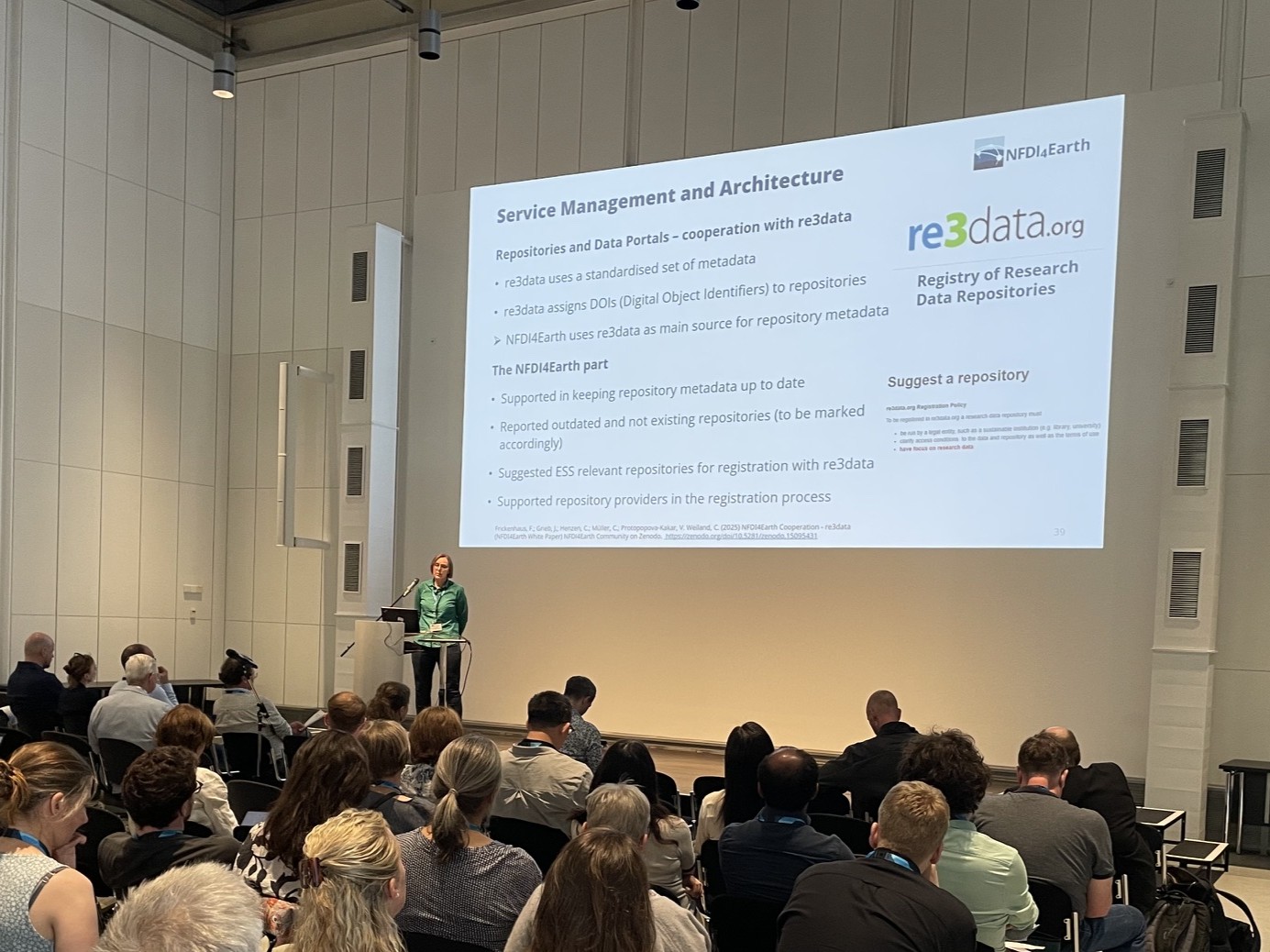
Synergies in Service (Information) Management
Kemeng Liu (liu.kemeng@uni-hamburg.de), Christin Henzen (christin.henzen@tu-dresden.de) with Christian Schäfer-Neth (Base4NFDI)
This workshop aims to bring together service users, service providers, and stakeholders involved in service and software information management across NFDI4Earth and related initiatives. It seeks to develop a shared understanding of how services are, and should be, described, integrated, operated, and monitored within a federated research infrastructure. A key focus is on aligning perspectives between service providers and users, while also sharing current approaches to service registration and management. Participants will explore how services can be categorized, onboarded, and integrated within NFDI4Earth as well as with external infrastructures. Through impulse talks and interactive discussions, the workshop will collect experiences, identify synergies, and outline potential next steps to improve the service information management ecosystem.
Shaping the interaction between the future Lighthouse Use Cases and NFDI4Earth
Sibylle Hassler (sibylle.hassler@kit.edu), Melanie Weynants (mweynants@bgc-jena.mpg.de), Peter Braesicke (peter.braesicke@dwd.de)
This workshop aims at initiating the dialogue between the Lighthouse Use Cases (LUCs) and the wider NFDI4Earth Consortium. The LUCs are selected research projects that have already implemened research data management (RDM) practices. The aim is to improve their RDM further within the NFDI4Earth context. The detailed mechanisms for the interactions between the different NFDI4Earth Task Areas (TAs) and the LUCs need to be jointly defined.
During the workshop we will discuss the mutual expectations of the LUCs and the TAs and how the results and practices developed by the LUCs can be integrated in NFDI4Earth. In particular, we want to define how to jointly develop Key Information Products (KIPs) and make them available through NFDI4Earth. Finally, we will discuss the potential generalisation of the LUCs developments and their adoption by other research projects, which is an important expected outcome of the LUCs.
Software Marketplace
Lexcube: A multi-platform data cube ecosystem for immersive visualization and exploration of Earth system data (Maximilian Söchting, Miguel D. Mahecha)
MaRESS - Mapping Research in Earth System Science (Benjamin Schmidt)
3Dtrees.earth: A platform for accessing, analyzing and visualizing LiDAR data in forest environments (Kilian Gerberding, Janusch Vajna-Jehle, Daniel Lusk, Björn Grüning, Teja Kattenborn, Maximilian Sperlich, Benjamin Brede, Thomas Seifert, Christian Scharinger, Julian Frey)
umwelt.info (Claudia Schütze)
TopoToolbox - a laboratory for quantitative geomorphology (Wolfgang Schwanghart, Anna-Lena Lamprecht, Dirk Scherler, Boris Gailleton, William S. Kearney)
RDMO Earth Sensor (Corinna Rebmann, Bjarne Biskamp)
OneStop4All (Tom Niers, Simon Jirka)
Knowledge Hub (Anna Brauer)
EduTrain Portal (Farzaneh Sadgehi, Carsten Kessler)
NFDI4Earth Label (Robert Brylka, Jonas Grieb)
Living Handbook (Jie Xu, Ivonne Anders)
Poster Presentations
User Support Network (Hela Mehrtens, Klaus Getzlaff, Ivonne Anders, Andrea Lammert)
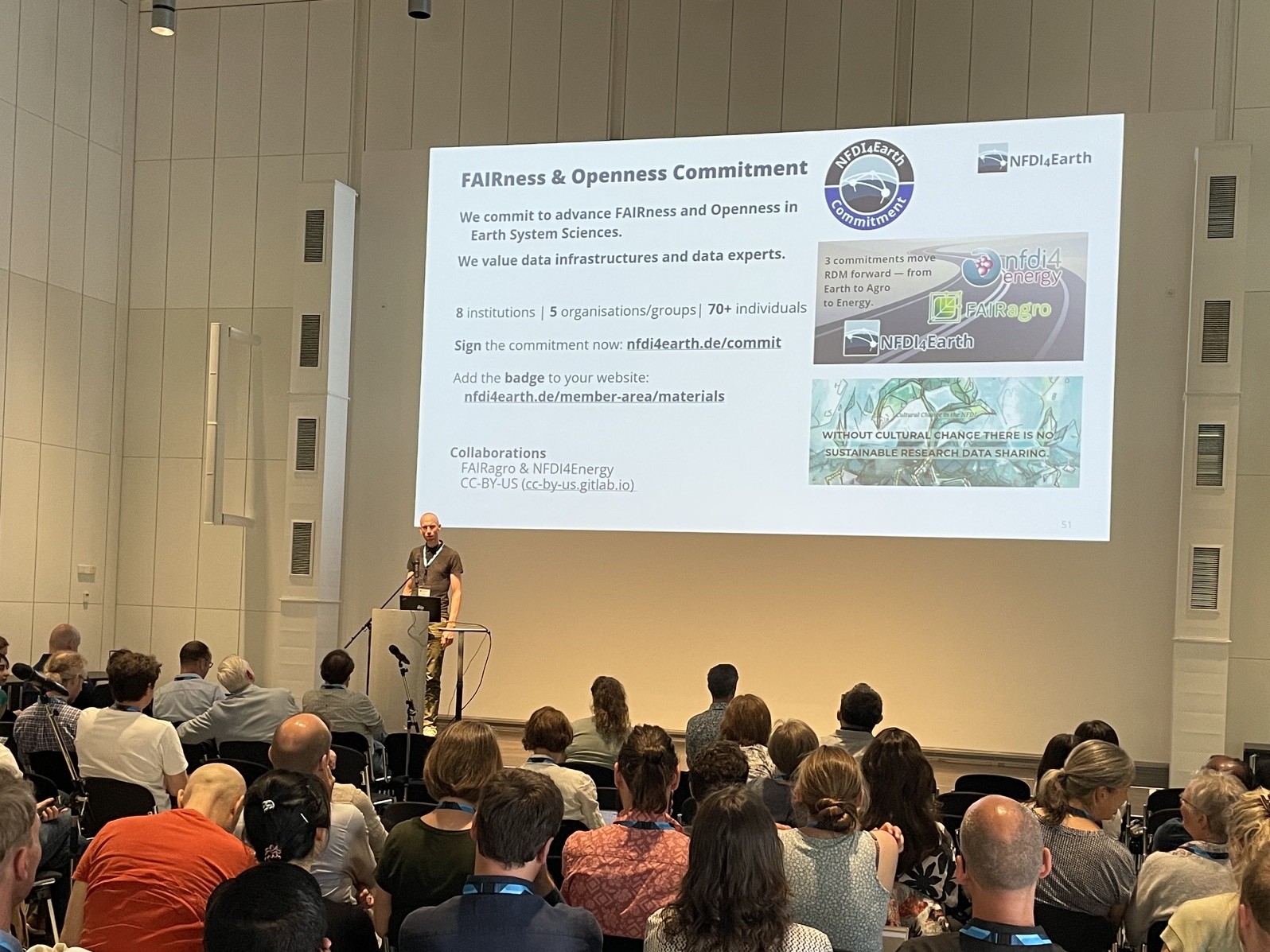
Openness and FAIRness Commitment (Andreas Hübner, Daniel Nüst)
European Research Infrastructures in Earth & Environment and NFDI4Earth’s Strategic Role (Valentina Kakar, Wolfgang Castell)
High-Value Data in Practice: Why Availability Is Not Enough (Astrid Ziemann, Klaus-Peter Wenz, Alois Wieshuber)
5 years of the IG "High-performance Computing in Earth System Sciences" in NFDI4Earth (Stephan Hachinger)
IG Long-Term Archiving (Andrea Lammert)
EOC Datenportal - Der neue Einstiegpunkt zu Fernerkundungsdaten des Earth Observation Center (Jan-Karl Haug)
umwelt.info – Making Environmental Data Discoverable (Claudia Schütze, Stefan Krämer)
Enhancing Spatial Data Discovery Using Large Language Models (James Okemwa Ondieki, Matthes Rieke, Simon Jirka)
find.software - Foundations for Interdisciplinary Discovery of (Research) Software (Ronny Gey, Daniel Mietchen, Oliver Karras, Ankit Satpute)
Service Portfolio Management in NFDI4Biodiversity (Maria Meister, Manuel Feser, Sarah Fischer-Zielke)
Base4NFDI (Najla Rettberg, Martin Reinhardt)
SoRa Geolinking Service: A FAIR Research Data Infrastructure for Social-Spatial Science (Gotthard Meinel, Jan Goebel, Stefan Jünger, Benjamin Zapilko, Theodor Rieche, Alexander Jung, Jonas Lieth, Sujit Kumar Sikder, Maria Nieswand)
Colouring Dresden: A Citizen Science Platform for the Collection, Validation, Analysis, Visualization, and Sharing of Building Data (Theodor Rieche, Sujit Sikder, Maria Nieswand, Robert Hecht)
WasserBLIcK: A Quarter Century of Federated Water Data Governance – Lessons Learned for Research Data Infrastructure (Stephan Hofmann)
The WMO Hydrological Observing System (WHOS) - Improving hydrological data exchange through federation and interoperability (Philipp Saile, Stephan Dietrich, Washington Otieno, Sylvain Grellet, Enrico Boldrini, Katharina Schleidt, Hylke van der Schaaf)
DBFZ Biomass Atlas – Web Map for Visualizing Spatial Biomass Potentials in Germany (Fabian Sittaro, Sebastian Semella, Tom Karras, Friederike Naegeli de Torres)
Incubator VISQAM (Eftychia Koukouraki)
Significance and Future of Data Infrastructures for the Geochemical Research Community (Gerhard Wörner)
How comparable are geochemical datasets really and why it matters (Marie Traun, A. Renno, L. Kallas, M. Willbold, T. Waight, D. Garbe-Schönberg & G. Wörner)
Digital Time Series Infrastructure for Environmental Observations - A Modular, Distributed and FAIR Ecosystem (Marc Hanisch, Nils Brinckmann, Claas Faber Martin Ingenbleek, Roland Koppe, Christof Lorenz, Ulrich Loup, David Schäfer )
time.IO – Digital Ecosystem for Time Series Data Management in Environmental System Science: From Architecture to Operation (D. Schäfer, M. Abbrent, N. Brinckmann, J .Hemmen, R. Kunkel, C. Lorenz, P. Lünenschloß, B. Palm, T. Schnicke, C. Schulz, H. van der Schaaf, and J. Bumberger)
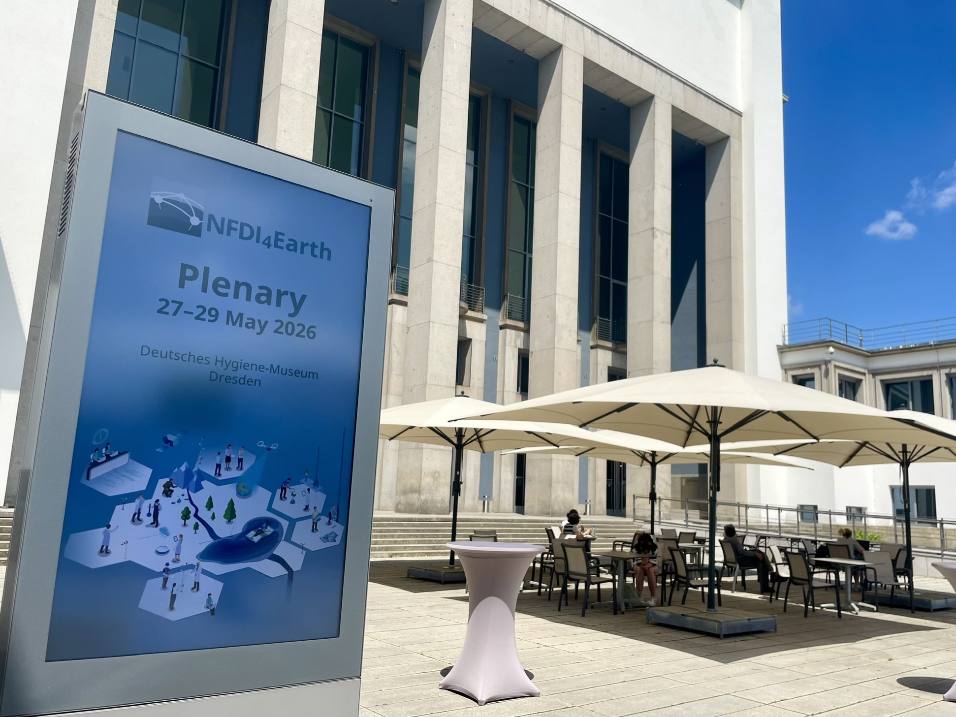
Deutsches Hygiene-Museum Dresden
Lingnerplatz 1, 01069 Dresden
Website Deutsches Hygiene-Museum Dresden
Located by the “Blüherpark“, the location is easily accessible from Dresden central station by foot, by public transport or by car.

It is only a 20 minute walk from the train station "Hauptbahnhof" to the “Deutsches Hygiene-Museum Dresden”.
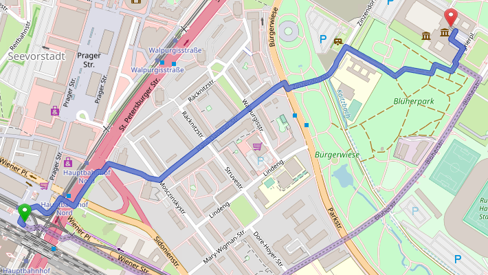
Karte hergestellt aus OpenStreetMap-Daten, Lizenz: ODbL

The tram “10 Striesen” can be taken from the tram stop “Hauptbahnhof” and will bring you to the tram stop “Georg-Arnold-Bad”. From there it is only a 5 minute walk to the location.
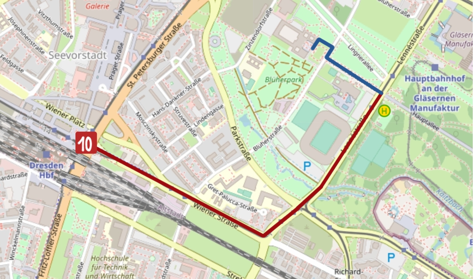
Karte hergestellt aus OpenStreetMap-Daten, Lizenz:ODbL

If you are arriving by car, you can either take the A4 motorway exit "Dresden-Hellerau" or the A17 motorway exit "Dresden-Südvorstadt" (see reference below). Either way, you will need to follow the B170 into the city centre. The "Linnéstraße" will guide you to „Helmut-Schön-Allee“ which will lead you to the museum.
Parking is available in
front of the “Georg-Arnold-Bad” or along the “Blüherstraße” or “Lingnerallee”. Fees
may apply.
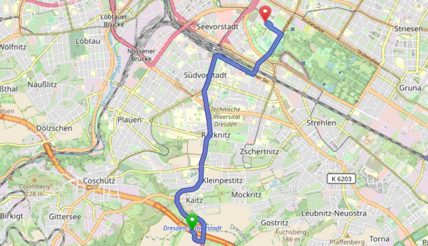
Karte hergestellt aus OpenStreetMap-Daten, Lizenz: ODbL
Do not hesitate to contact the NFDI4Earth coordination office in the case of problems or organisational questions.
We are looking forward to having you!